Snyder, Colorado facts for kids
Quick facts for kids
Snyder, Colorado
|
|
|---|---|

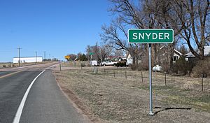
Snyder, looking north on Colorado State Highway 71
|
|

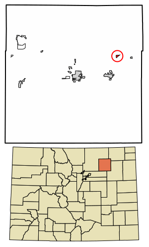
Location in Morgan County, Colorado
|
|
| Country | |
| State | |
| County | Morgan County |
| Government | |
| • Type | unincorporated community |
| Area | |
| • Total | 0.354 sq mi (0.917 km2) |
| • Land | 0.354 sq mi (0.917 km2) |
| • Water | 0 sq mi (0.000 km2) |
| Elevation | 4,180 ft (1,274 m) |
| Population
(2010)
|
|
| • Total | 136 |
| • Density | 384/sq mi (148.3/km2) |
| Time zone | UTC-7 (MST) |
| • Summer (DST) | UTC-6 (MDT) |
| ZIP Code |
80750
|
| Area code(s) | 970 |
| GNIS feature | Snyder CDP |
Snyder is a small community in Colorado, United States. It is located in Morgan County. Snyder is known as an unincorporated town. This means it is not officially a city or town with its own local government. It is also a census-designated place (CDP). This means the U.S. Census Bureau counts its population separately for statistics. Snyder is part of the larger Fort Morgan area. In 2020, about 136 people lived there. It has its own post office with the ZIP Code 80750.
A Look at Snyder's Past
Snyder got its name from a man named J.W. Snyder. He was a pioneer rancher who lived from 1837 to 1922. A pioneer rancher is someone who was among the first to settle and raise animals in a new area.
Where is Snyder?
Snyder is located in the eastern part of Morgan County. It sits on the north side of the valley of the South Platte River. The community is about 15 miles (24 km) northeast of Fort Morgan. Fort Morgan is the main town and county seat of Morgan County.
Colorado State Highway 71 goes right through Snyder. This highway leads south about 6 miles (10 km) to Brush. It also goes north about 67 miles (108 km) to Kimball, Nebraska. The Snyder CDP covers an area of about 0.917 square kilometers (0.354 sq mi). All of this area is land.
How Many People Live Here?
The United States Census Bureau first defined Snyder as a CDP for the United States Census 2010. This means they started counting its population as a separate place then.
| Snyder CDP, Colorado | ||
|---|---|---|
| Year | Pop. | ±% |
| 2010 | 132 | — |
| 2020 | 136 | +3.0% |
| Source: United States Census Bureau | ||
See also
 In Spanish: Snyder (Colorado) para niños
 | Audre Lorde |
 | John Berry Meachum |
 | Ferdinand Lee Barnett |


