
Somerset, Colorado facts for kids
Quick facts for kids
Somerset, Colorado
|
|
|---|---|

Coal train near Somerset, August 2011
|
|

Somerset, Colorado
Location in Colorado
|
|
| Country | |
| State | |
| County | Gunnison County |
| Government | |
| • Type | unincorporated town |
| Area | |
| • Total | 0.190 sq mi (0.492 km2) |
| • Land | 0.190 sq mi (0.492 km2) |
| • Water | 0 sq mi (0.000 km2) |
| Elevation | 5,998 ft (1,828 m) |
| Population
(2020)
|
|
| • Total | 55 |
| • Density | 289.5/sq mi (111.8/km2) |
| Time zone | UTC-7 (MST) |
| • Summer (DST) | UTC-6 (MDT) |
| ZIP Code |
81434
|
| Area code(s) | 970 |
| GNIS feature ID | 2805921 |
Somerset is a small community in Gunnison County, Colorado, United States. It's called a census-designated place (CDP), which means it's an area the government tracks for population numbers.
Somerset also has its own post office. In 2020, only 55 people lived there. The post office uses the ZIP Code 81434.
Contents
History of Somerset
Somerset got its name from a town called Somerset in Pennsylvania.
Energy Plant Development
In 2012, a company called Aspen Skiing Company built a special power plant in Somerset. This plant uses methane gas from the Elk Creek Mine to make electricity. It can produce 3 megawatts of power.
Geography and Location
Somerset is a small place, covering about 0.492 square kilometers (or 0.19 square miles) of land. It does not have any water areas within its boundaries.
Population and People
The United States Census Bureau keeps track of how many people live in places like Somerset.
Population Changes Over Time
The population of Somerset was officially counted during the United States Census 2020.
| Somerset CDP, Colorado | ||
|---|---|---|
| Year | Pop. | ±% |
| 2020 | 55 | — |
| Source: United States Census Bureau | ||
Images for kids
-
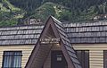
Somerset Post Office, July 2016
.jpg)
