Sostra Heights facts for kids
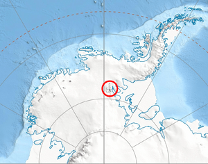
Sostra Heights are a group of tall hills in Antarctica. They are found on the eastern side of the northern Sentinel Range, which is part of the Ellsworth Mountains. The highest point in Sostra Heights is Mount Malone, reaching 2,460 meters (about 8,070 feet) high.
These heights stretch for about 22 kilometers (13.7 miles) from northwest to southeast. They also go about 16.5 kilometers (10.3 miles) from northeast to southwest.
Sostra Heights are surrounded by large ice formations. The Embree Glacier is to the south, and the Sabazios Glacier is to the west. To the north is the Newcomer Glacier, and the Rutford Ice Stream is to the east. A place called Robinson Pass separates Sostra Heights from a nearby ridge. This ridge extends from Mount Dalrymple, which is on the main crest of the Sentinel Range. Inside Sostra Heights, the land is carved by the Anchialus Glacier and the Vit Ice Piedmont.
The name "Sostra Heights" comes from an old Roman fortress. This fortress was called Sostra and was located in Northern Bulgaria.
Where are Sostra Heights?
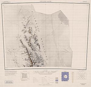
Sostra Heights are located in a specific spot in Antarctica. Their center point is at 77°53′00″S, 85°28′00″W. Maps of this area were first made by the United States in 1961.
What are the main features?
Sostra Heights has many interesting natural features. These include glaciers, peaks, and ice fields. Here are some of the important ones:
Maps
 | John T. Biggers |
 | Thomas Blackshear |
 | Mark Bradford |
 | Beverly Buchanan |


