
South Atlantic–Gulf water resource region facts for kids
The South Atlantic–Gulf water resource region is one of 21 big areas in the United States that help us understand where water flows. Think of these areas as giant natural bowls that collect water from rain and rivers. The United States Geological Survey (USGS) uses these regions to organize how they study water across the country. Each region includes all the land where water drains into a major river or a group of rivers.
This South Atlantic–Gulf region is special because its water eventually flows into either the Atlantic Ocean or the Gulf of Mexico. It's a huge area, covering about 141,984 square miles (367,736 km²)! The USGS gives it a special code: 03.
Where is This Water Region?
This large water region covers all of Florida and South Carolina. It also includes parts of many other states. These are Alabama, Georgia, Louisiana, Mississippi, North Carolina, Tennessee, and Virginia.
So, if you live in these states, the water around you is likely part of the South Atlantic–Gulf region. This means that the rain that falls there, and the rivers that flow through it, all end up in the Atlantic Ocean or the Gulf of Mexico.

How is This Region Divided?
To make it easier to study, the South Atlantic–Gulf region is split into 18 smaller parts. These smaller parts are called "subregions." Each subregion also has its own special code, starting with 03. For example, the first subregion is 0301, and the last is 0318.
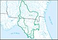
Each subregion covers a specific area where water drains into certain rivers or coastal waters. For instance, some subregions cover the land that drains into the Chowan River and Roanoke River in Virginia and North Carolina. Others cover areas like the St. Johns River in Florida or the Alabama River in Alabama.
These divisions help scientists understand how water moves through the land. They can study things like water quality, floods, and droughts in each specific area. This helps them manage our water resources better.
Images for kids
-
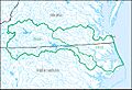
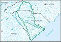
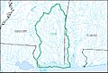
Chowan–Roanoke Subregion
-
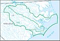
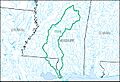
Neuse–Pamlico Subregion
-
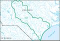
Cape Fear Subregion
-
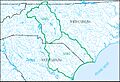
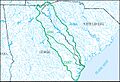
Pee Dee Subregion
-
Edisto–Santee Subregion
-
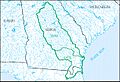
Ogeechee–Savannah Subregion
-
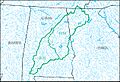
Altamaha–St. Marys Subregion
-
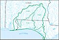
St. Johns Subregion
-
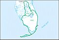
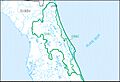
Southern Florida Subregion
-
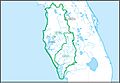
Peace–Tampa Bay Subregion
-
Suwannee Subregion
-
Ochlockonee Subregion
-
Apalachicola Subregion
-
Choctawhatchee–Escambia Subregion
-
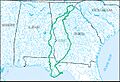
Alabama Subregion
-
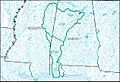
Mobile–Tombigbee Subregion
-
Pascagoula Subregion
-
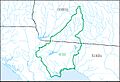
Pearl Subregion


