South Run (Bowman Creek tributary) facts for kids
Quick facts for kids South Run |
|
|---|---|

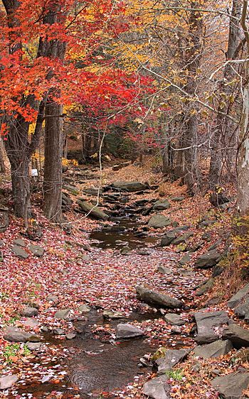
South Run looking upstream from Buckwheat Hollow Road
|
|
| Other name(s) | South Run Creek |
| Physical characteristics | |
| Main source | broad valley near Hickory Knob in Monroe Township, Wyoming County, Pennsylvania between 1,180 and 1,200 feet (360 and 366 m) |
| River mouth | Bowman Creek in Monroe Township, Wyoming County, Pennsylvania 899 ft (274 m) 41°25′16″N 76°01′57″W / 41.4212°N 76.0326°W |
| Length | 2.5 mi (4.0 km) |
| Basin features | |
| Progression | Bowman Creek → Susquehanna River → Chesapeake Bay |
| Basin size | 3.42 sq mi (8.9 km2) |
South Run, also called South Run Creek, is a small stream in Wyoming County, Pennsylvania. It flows into Bowman Creek. This stream is about 2.5 miles (4.0 km) long. It runs through Monroe Township. The area of land that drains into South Run is about 3.42 square miles (8.9 km2).
South Run is a healthy stream. It is known as a great place for coldwater fish. It is also important for fish that travel to lay eggs.
Contents
Where Does South Run Flow?
South Run starts in a wide valley. This area is near a place called Hickory Knob in Monroe Township. It first flows north for a short distance. Then, its valley gets narrower. The stream then turns to the northwest.
After a bit, it turns north again. It flows north for a short distance. Then it turns northwest, and then north one more time. Finally, South Run meets up with Bowman Creek. South Run joins Bowman Creek about 11.68 miles (18.80 km) before Bowman Creek ends.
What is the Land Like Around South Run?
The land around South Run is mostly made of alluvium. This is a type of soil left behind by flowing water. There are also large areas of till in the stream's watershed. Till is rock and soil left by glaciers. This specific type is called Wisconsinan Till.
Near where South Run joins Bowman Creek, there is a patch of alluvial terrace. This is a flat area of land formed by old river deposits.
There is also a spring in the area that feeds South Run. A spring is a place where groundwater flows out of the ground.
What is the South Run Watershed?
The watershed of South Run covers about 3.42 square miles (8.9 km2). A watershed is all the land where water drains into a specific stream or river. South Run is completely within the Noxen area. This area is mapped by the United States Geological Survey.
Some farmland is located near South Run. This land is in the 100-year floodplain of the stream. A floodplain is an area of low-lying ground next to a river. It is likely to be flooded at certain times.
History of South Run
South Run was officially added to the Geographic Names Information System on August 2, 1979. This system keeps track of names and locations of places. The stream is also known as South Run Creek.
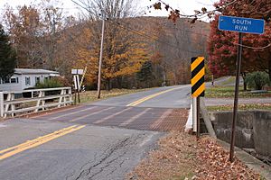
Several bridges cross South Run. A concrete bridge was built in 1941. It carries State Route 2001 over the stream. This bridge is 29.9 feet (9.1 m) long. Another bridge on the same road was also built in 1941. It is 26.9 feet (8.2 m) long. A third bridge was built in 1954. It is 24.0 feet (7.3 m) long. As of 2014, one of these bridges needed to be replaced.
Animals and Plants in South Run
The watershed of South Run is a special place for fish. It is called a High-Quality Coldwater Fishery. This means the water is cold and clean enough for fish that need cool temperatures. It is also a Migratory Fishery. This means fish travel through it.
Wild trout live and reproduce naturally in South Run. They can be found from where the stream starts all the way to where it ends.
 | Roy Wilkins |
 | John Lewis |
 | Linda Carol Brown |


