South San Gabriel, California facts for kids
Quick facts for kids
South San Gabriel, California
|
|
|---|---|

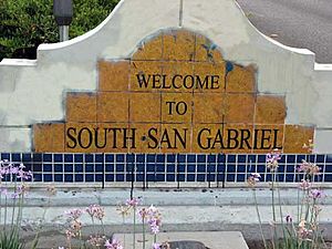
South San Gabriel welcome sign
|
|

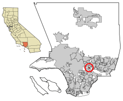
Location of South San Gabriel in Los Angeles County, California.
|
|
| Country | |
| State | |
| County | |
| Area | |
| • Total | 0.833 sq mi (2.158 km2) |
| • Land | 0.833 sq mi (2.158 km2) |
| • Water | 0 sq mi (0.001 km2) 0.03% |
| Elevation | 272 ft (83 m) |
| Population
(2020)
|
|
| • Total | 7,920 |
| • Density | 9,508/sq mi (3,670/km2) |
| Time zone | UTC-8 (PST) |
| • Summer (DST) | UTC-7 (PDT) |
| ZIP code |
91770
|
| Area code(s) | 626 |
| FIPS code | 06-73276 |
| GNIS feature ID | 1652796 |
South San Gabriel is a community in Los Angeles County, California, United States. It is known as a census-designated place (CDP). This means it's a special area defined by the government for counting people.
In 2020, about 7,920 people lived here. In 2010, the population was 8,070. This was an increase from 7,595 people in 2000.
Contents
Where is South San Gabriel?
South San Gabriel is located in California. You can find it at these coordinates: 34°2′57″N 118°5′43″W / 34.04917°N 118.09528°W.
The United States Census Bureau says that South San Gabriel covers a total area of about 0.8 square miles (2.2 km2). Almost all of this area is land.
Who Lives in South San Gabriel?
| Historical population | |||
|---|---|---|---|
| Census | Pop. | %± | |
| 1970 | 5,051 | — | |
| 1980 | 5,421 | 7.3% | |
| 1990 | 7,700 | 42.0% | |
| 2000 | 7,595 | −1.4% | |
| source: | |||
This section shares information about the people living in South San Gabriel. This data comes from official counts called censuses.
Population in 2010
In 2010, South San Gabriel had 8,070 residents. This means there were about 9,684.6 inhabitants per square mile (3,739.2/km2) people per square mile.
The community is very diverse. Many different groups of people live here. About 49.4% of the people were Asian. About 27.2% were White. Around 17.7% were from other races. About 1.0% were African American, and 0.7% were Native American. About 3.9% of people identified as two or more races.
A large part of the population, about 42.7%, identified as Hispanic or Latino.
Most people (97.1%) lived in regular homes. There were 2,249 households in total. Many households (38.9%) had children under 18 living there. The average household had about 3.48 people.
The ages of people in South San Gabriel varied. About 20.4% were under 18 years old. About 26.1% were between 25 and 44 years old. About 16.8% were 65 years or older. The average age was 40.5 years.
Most homes were owned by the people living in them (71.0%). The rest (29.0%) were rented.
Population in 2000
In 2000, there were 7,595 people living in South San Gabriel. There were 2,091 households. The population density was 9,106.3 inhabitants per square mile (3,516.0/km2).
The community was also diverse in 2000. About 33.34% of residents were Asian. About 19.93% were from other races. About 11.72% were White. About 64.96% of the population was Hispanic or Latino.
About 37.6% of households had children under 18. The average household size was 3.52 people.
The median age in 2000 was 36 years. About 25.0% of the population was under 18 years old. About 14.1% were 65 years or older.
Schools in South San Gabriel
Students in South San Gabriel attend schools in two different school districts:
- The Montebello Unified School District
- The Garvey School District
Some of the schools that serve the community include:
- Potrero Heights Elementary School (in Los Angeles County)
- Macy Intermediate School (in Monterey Park)
- Schurr High School (in Montebello)
See also
 You can also find information about South San Gabriel in Spanish: South San Gabriel para niños
 | James Van Der Zee |
 | Alma Thomas |
 | Ellis Wilson |
 | Margaret Taylor-Burroughs |


