South Tipperary facts for kids
Quick facts for kids
South Tipperary
Tiobraid Árann Theas
Tipperary (South Riding)
|
||
|---|---|---|
|
Former County
1899–2014 |
||
|
||
| Motto(s): | ||
 |
||
| Country | Ireland | |
| Province | Munster | |
| Created | 1 April 1899 | |
| Abolished | 1 June 2014 | |
| County town | Clonmel | |
| Government | ||
| • Type | South Tipperary County Council | |
| Area | ||
| • Total | 2,257 km2 (871 sq mi) | |
| Population
(2011)
|
88,433 | |
| Car plates | TS (1987–2013) | |
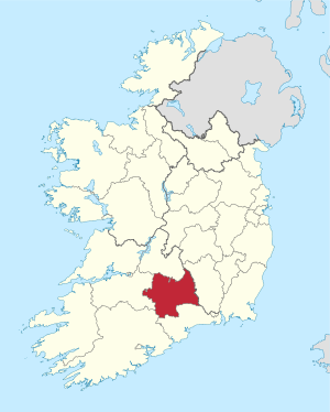
South Tipperary (Irish: Tiobraid Árann Theas) was a special area in Ireland. It was like a county within the larger County Tipperary. This area was in the Munster province.
It got its name from the town of Tipperary. South Tipperary covered about half of the land area of the traditional County Tipperary. The South Tipperary County Council was the group that managed the area. They made decisions about local services. In 2011, about 88,433 people lived there. On June 1, 2014, South Tipperary joined with North Tipperary. Together, they became one big County Tipperary again. A new Tipperary County Council now looks after the whole county.
Contents
Exploring South Tipperary's Geography
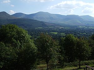
South Tipperary was mostly flat land, part of Ireland's central plain. But it also had some cool mountain ranges. These included the Knockmealdowns and the Galtees.
The area had no coast, meaning it was landlocked. The River Suir flowed through it, draining the land. A special part of the county was the Golden Vale. This is a very rich farming area in the Suir river basin. It also stretches into counties Limerick and Cork.
The main town in South Tipperary was Clonmel. Other important towns were Carrick-on-Suir, Cashel, Cahir, and Tipperary. The county's motto was Vallis Aurea Siurensis. This means "The Golden Vale of the Suir".
What are Baronies?
South Tipperary had six historic areas called baronies. These were:
- Clanwilliam
- Iffa and Offa East
- Iffa and Offa West
- Kilnamanagh Lower
- Middle Third
- Slievardagh
How were Civil Parishes Used?
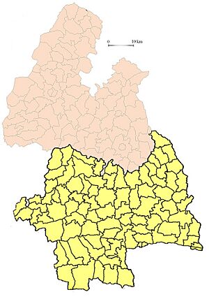
Civil parishes in Ireland were smaller sections of land. They were created after a big land survey called the Down Survey. Each barony had many parishes, and each parish had many townlands. These parishes were used for local taxes. They also appeared on old maps made by the Ordnance Survey of Ireland. Later, in the mid-1800s, new areas called district electoral divisions took their place for managing aid to the poor. South Tipperary had 123 civil parishes.
The Irish Language in South Tipperary
Some people in South Tipperary spoke Irish as their first language. This continued until the middle of the 1900s. Recordings of how they spoke have been saved. These recordings were made before the last native speakers passed away. The Royal Irish Academy Library has made these recordings available.
 | Mary Eliza Mahoney |
 | Susie King Taylor |
 | Ida Gray |
 | Eliza Ann Grier |


