South Uist facts for kids
| Gaelic name | Uibhist-a-Deas |
|---|---|
| Meaning of name | From 'inni-vist', Old Norse for 'dwelling'. |
| OS grid reference | NF786343 |
| Physical geography | |
| Island group | Uists & Barra |
| Area | 32,026 ha |
| Area rank | 9 |
| Highest elevation | Beinn Mhor 620 m |
| Administration | |
| Sovereign state | United Kingdom |
| Country | Scotland |
| Council area | Na h-Eileanan Siar |
| Demographics | |
| Population | 1,818 |
| Largest settlement | Lochboisdale |
South Uist (in Scottish Gaelic: Uibhist-a-Deas) is a beautiful island located in the Outer Hebrides, a group of islands off the coast of Scotland. It's a place where history, nature, and a unique culture come together. In 2001, about 1,818 people lived here.
South Uist is special for many reasons. It has a nature reserve where you can see amazing wildlife. There are also many interesting archaeological sites. These are places where scientists study the past by digging up old objects and buildings. One very unique discovery on South Uist was prehistoric mummies. These are the only ones ever found in Great Britain!
The island is also a strong center for the Gaelic language. Many people here speak Gaelic, keeping this ancient language alive. In 2006, something big happened: the people of South Uist, along with those on nearby Benbecula and Eriskay, bought a large part of the island. This was Scotland's biggest "community land buyout" at the time, meaning the local people now own and manage the land.
Contents
Exploring South Uist
South Uist is known for its stunning landscapes, from sandy beaches to rugged mountains. The island is long and narrow, with a flat, sandy west coast and a more rocky, mountainous east coast.
Island Life and Culture
Life on South Uist is deeply connected to its history and traditions. The island is one of the last places in Scotland where the Gaelic language is still widely spoken. This makes it a special place to experience a unique part of Scottish culture. Most people on the island are Roman Catholic, which is an important part of the community's identity.
The main village on South Uist is Lochboisdale. It's a busy hub where ferries arrive and depart, connecting the island to the mainland and other islands.
Ancient Discoveries
South Uist has a rich history, with many clues from people who lived there thousands of years ago.
- Prehistoric Mummies: One of the most amazing finds was at a place called Cladh Hallan. Here, archaeologists found the remains of people who were mummified in prehistoric times. This is a very rare discovery for Great Britain.
- Ancient Settlements: You can also find old stone circles, standing stones, and the remains of ancient homes called roundhouses. These show how people lived and built their communities long ago.
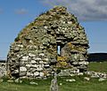
- Brochs and Castles: The island also has the ruins of brochs, which are ancient stone towers, like Dun Vulan. There are also remains of old castles, such as Calvay Castle and Ormaclete Castle, which tell stories of chiefs and clans from hundreds of years ago.
Nature and Wildlife
South Uist is a paradise for nature lovers.
- Nature Reserve: The island is home to a large nature reserve, especially around Loch Druidibeg. This area is protected to help different kinds of birds and other animals thrive.
- Machair: The west coast of South Uist has a special type of grassy plain called "machair." This land is very fertile and bursts with colorful wildflowers in the summer. It's also an important habitat for rare birds.
- Birds: Many different bird species live on or visit South Uist. It's a great place for birdwatching, especially for wading birds and birds of prey.
Modern Uses
In the northwest part of South Uist, there is a missile testing range. This is a special area used by the military to test rockets and missiles. It's a controlled area and not open to the public.
Images for kids
-
Looking west to Nicolson's Leap. In the background are Gèideabhal, also known as Beinn Mhòr, on the left, and Hecla on the right.
-
Flowering machair on South Uist
See also
 In Spanish: South Uist para niños
 | Misty Copeland |
 | Raven Wilkinson |
 | Debra Austin |
 | Aesha Ash |


