
South Zanesville, Ohio facts for kids
Quick facts for kids
South Zanesville, Ohio
|
|
|---|---|
|
Village
|
|

Train and houses in South Zanesville
|
|

Location of South Zanesville, Ohio
|
|

Location of South Zanesville in Muskingum County
|
|
| Country | United States |
| State | Ohio |
| County | Muskingum |
| Townships | Springfield, Newton |
| Area | |
| • Total | 0.80 sq mi (2.08 km2) |
| • Land | 0.80 sq mi (2.08 km2) |
| • Water | 0.00 sq mi (0.00 km2) |
| Elevation | 742 ft (226 m) |
| Population
(2020)
|
|
| • Total | 1,894 |
| • Density | 2,355.72/sq mi (909.67/km2) |
| Time zone | UTC-5 (Eastern (EST)) |
| • Summer (DST) | UTC-4 (EDT) |
| ZIP code |
43701
|
| Area code(s) | 740 |
| FIPS code | 39-73894 |
| GNIS feature ID | 2399863 |
South Zanesville is a small community called a village in Ohio, USA. It's located in Muskingum County, Ohio, right by the Muskingum River. A small stream called Moxahala Creek also flows nearby. In 2020, about 1,894 people lived there. South Zanesville is part of the larger Zanesville area.
Contents
Geography of South Zanesville
South Zanesville is located in the state of Ohio. The village covers a total area of about 2.08 square kilometers (0.80 square miles). All of this area is land, meaning there are no large lakes or rivers within the village limits.
Population and People
The number of people living in South Zanesville has changed over the years. Here's how the population has grown and shrunk:
| Historical population | |||
|---|---|---|---|
| Census | Pop. | %± | |
| 1910 | 853 | — | |
| 1920 | 1,010 | 18.4% | |
| 1930 | 1,278 | 26.5% | |
| 1940 | 1,338 | 4.7% | |
| 1950 | 1,477 | 10.4% | |
| 1960 | 1,557 | 5.4% | |
| 1970 | 1,436 | −7.8% | |
| 1980 | 1,739 | 21.1% | |
| 1990 | 1,969 | 13.2% | |
| 2000 | 1,936 | −1.7% | |
| 2010 | 1,989 | 2.7% | |
| 2020 | 1,894 | −4.8% | |
| U.S. Decennial Census | |||
Population in 2010
In 2010, a census counted 1,989 people living in South Zanesville. There were 830 households, which are groups of people living together in one home. Out of these, 539 were families.
The village had about 902 housing units, like houses or apartments. The population density was about 925 people per square kilometer (2,396 people per square mile). This means a lot of people live in a small space.
Most of the people in the village were White (94.1%). About 3.0% were African American, and smaller groups were Native American or Asian. About 2.4% of the people were from two or more different backgrounds. A small number (0.3%) were Hispanic or Latino.
Households and Families
Out of the 830 households, about 34.9% had children under 18 living there. About 39.0% were married couples living together. Some households had a single parent: 18.4% had a female head of household with no husband, and 7.5% had a male head of household with no wife. About 35.1% of households were not families.
Almost 30% of all households had only one person living there. About 12.1% of households had someone aged 65 or older living alone. On average, each household had 2.40 people, and each family had 2.90 people.
The average age of people in the village was 37.1 years old. About 25.9% of residents were under 18. About 13.4% were 65 years old or older. The village had slightly more females (51.7%) than males (48.3%).
Local High School
Students in South Zanesville can attend Maysville High School.
Images for kids
-
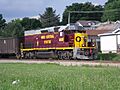
Train and houses in South Zanesville
-
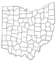
Location of South Zanesville, Ohio
-
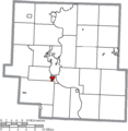
Location of South Zanesville in Muskingum County
See also
 In Spanish: South Zanesville (Ohio) para niños
