Southern Indian Lake facts for kids
Quick facts for kids Southern Indian Lake |
|
|---|---|
 |
|
| Location | Division No. 23, Manitoba, Canada |
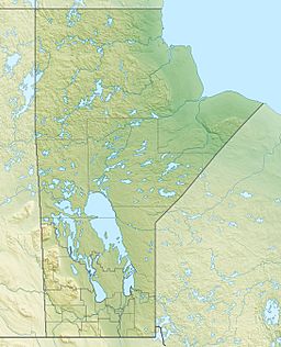
| Coordinates | 57°10′N 98°30′W / 57.167°N 98.500°W |
| Primary inflows | Churchill River |
| Primary outflows | Churchill River and Rat River |
| Catchment area | 242,000 km2 (93,000 sq mi) |
| Basin countries | Canada |
| Surface area | 2,247 km2 (868 sq mi) |
| Average depth | 9.8 m (32 ft) |
| Max. depth | 30 m (98 ft) |
| Water volume | 23.4 km3 (19,000,000 acre⋅ft) |
| Shore length1 | 3,798 km (2,360 mi) |
| Surface elevation | 258 m (846 ft) |
| Frozen | between October–June |
| Islands | many |
| Settlements | South Indian Lake |
| 1 Shore length is not a well-defined measure. | |
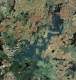
Southern Indian Lake is a very large lake located in Manitoba, Canada. It covers an area of about 2,247 km2 (868 sq mi), which includes its many islands. The surface of the lake is about 258 m (846 ft) above sea level.
This lake is the fourth largest lake in Manitoba. It has a very interesting shape with lots of islands, long pieces of land sticking out into the water called peninsulas, and deep bays. The important Churchill River flows right through Southern Indian Lake.
The small community of South Indian Lake is found on the southeast side of the lake. It's about 130 km (81 mi) by air north of the city of Thompson. This community is the main home for the O-Pipon-Na-Piwin Cree Nation, which is a First Nations group.
Contents
History of the Lake
Southern Indian Lake has been known for a long time. It was shown on a map made by a person named Fidler way back in 1814.
Getting to Southern Indian Lake
You can reach the lake and its community in a couple of ways. There's a small airport called the South Indian Lake Airport. You can also drive there using Manitoba Provincial Road 493 (Pr493). This road is made of gravel and starts at Leaf Rapids. It then goes northeast for about 219.1 km (136.1 mi) until it reaches South Indian Lake. The closest big city, Thompson, is about 436 km (271 mi) away by road.
Churchill River Diversion Project
A big project called the Churchill River Diversion is part of the Nelson River Hydroelectric Project. This project changes how some of the Churchill River flows. At a place called Missi Falls, which is where the lake naturally drains, some of the river's water is sent south into the Rat River.
- Controlling the Water: A special dam at Missi Falls, called the Missi Falls Control Structure, was built. This dam raised the lake's water level by 3 metres (about 10 feet).
- New Water Channels: A new channel was also dug. It goes from South Bay of Southern Indian Lake to another lake called Issett Lake.
- Managing Flow to Nelson River: Further down, another dam at Notigi, called the Notigi Control Structure, helps control how much water flows into the Nelson River system.
See also
 In Spanish: Lago Southern Indian para niños
 | Ernest Everett Just |
 | Mary Jackson |
 | Emmett Chappelle |
 | Marie Maynard Daly |


