Southern Ute, Colorado facts for kids
Quick facts for kids
Southern Ute, Colorado
|
|
|---|---|

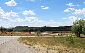
Southern Ute, south of State Highway 151, August 2019.
|
|

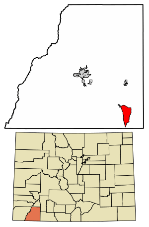
Location of the Southern Ute CDP in La Plata County, Colorado.
|
|
| Country | |
| State | |
| County | La Plata County |
| Government | |
| • Type | unincorporated community |
| Area | |
| • Total | 15.960 sq mi (41.335 km2) |
| • Land | 15.960 sq mi (41.335 km2) |
| • Water | 0 sq mi (0.000 km2) |
| Elevation | 6,565 ft (2,001 m) |
| Population
(2020)
|
|
| • Total | 158 |
| • Density | 9.900/sq mi (3.822/km2) |
| Time zone | UTC-7 (MST) |
| • Summer (DST) | UTC-6 (MDT) |
| ZIP Code |
Ignacio 81137
|
| Area code(s) | 970 |
| GNIS feature ID | 2583299 |
Southern Ute is a special kind of community called a census-designated place (CDP). It is located on the Southern Ute Indian Reservation in southern La Plata County, Colorado, in the United States. A CDP is an area that looks like a town but isn't officially governed by its own local government.
In 2020, about 158 people lived in the Southern Ute CDP. The local post office that serves this area is in Ignacio, and its Zip Code is 81137.
What's in a Name?
The name "Southern Ute" comes from the Southern Ute people. This community is part of their historic land, the Southern Ute Indian Reservation.
Where is Southern Ute Located?
The Southern Ute CDP covers an area of about 41.335 square kilometers (which is about 10,214 acres). All of this area is land, with no water bodies like lakes or rivers within its boundaries.
How Many People Live Here?
The United States Census Bureau counts how many people live in different areas. They first officially recognized Southern Ute as a CDP for the United States Census 2010.
Here's how the population has changed:
| Southern Ute CDP, Colorado | ||
|---|---|---|
| Year | Pop. | ±% |
| 2010 | 177 | — |
| 2020 | 158 | −10.7% |
| Source: United States Census Bureau | ||
See also
 In Spanish: Southern Ute (Colorado) para niños


