Sparks, Georgia facts for kids
Quick facts for kids
Sparks, Georgia
|
|
|---|---|

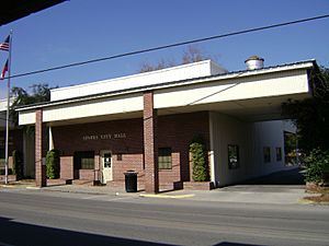
Sparks City Hall
|
|

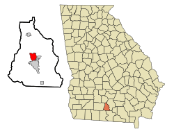
Location in Cook County and the state of Georgia
|
|
| Country | United States |
| State | Georgia |
| County | Cook |
| Area | |
| • Total | 4.14 sq mi (10.72 km2) |
| • Land | 3.97 sq mi (10.27 km2) |
| • Water | 0.17 sq mi (0.45 km2) |
| Elevation | 240 ft (73 m) |
| Population
(2020)
|
|
| • Total | 2,043 |
| • Density | 515.13/sq mi (198.90/km2) |
| Time zone | UTC-5 (Eastern (EST)) |
| • Summer (DST) | UTC-4 (EDT) |
| ZIP code |
31647
|
| Area code(s) | 229 |
| FIPS code | 13-72556 |
| GNIS feature ID | 0333097 |
Sparks is a small town located in Cook County, Georgia, in the United States. In 2020, about 2,043 people lived there.
Contents
How Sparks Got Its Name
The town of Sparks got its name from W.B. Sparks. He was the president of a railway company called the Georgia Southern and Florida Railway. A post office opened in Sparks in 1888. That same year, the state government of Georgia officially made Sparks a town.
Where is Sparks Located?
Sparks is located in the middle of Cook County. It is right next to Adel, which is the main town and county seat of Cook County.
Roads and Travel
A major road, U.S. Route 41, goes through the center of Sparks. It is known as Goodman Street in town. Another big highway, Interstate 75, runs along the west side of Sparks. You can get onto Interstate 75 from Exit 41.
Nearby Cities
- Tifton is about 20 miles (32 km) north of Sparks.
- Valdosta is about 26 miles (42 km) south of Sparks.
Land and Water
The town of Sparks covers a total area of about 4.1 square miles (10.7 square kilometers). Most of this area is land, about 3.9 square miles (10.1 square kilometers). A small part, about 0.2 square miles (0.6 square kilometers), is water.
Who Lives in Sparks?
| Historical population | |||
|---|---|---|---|
| Census | Pop. | %± | |
| 1890 | 307 | — | |
| 1900 | 683 | 122.5% | |
| 1910 | 842 | 23.3% | |
| 1920 | 792 | −5.9% | |
| 1930 | 635 | −19.8% | |
| 1940 | 695 | 9.4% | |
| 1950 | 887 | 27.6% | |
| 1960 | 1,158 | 30.6% | |
| 1970 | 1,337 | 15.5% | |
| 1980 | 1,353 | 1.2% | |
| 1990 | 1,205 | −10.9% | |
| 2000 | 1,755 | 45.6% | |
| 2010 | 2,052 | 16.9% | |
| 2020 | 2,043 | −0.4% | |
| U.S. Decennial Census 1850-1870 1870-1880 1890-1910 1920-1930 1940 1950 1960 1970 1980 1990 2000 2010 |
|||
Population Makeup in 2020
In 2020, the United States Census counted 2,043 people living in Sparks. There were 778 households, which are groups of people living together. Out of these, 572 were families.
The table below shows the different groups of people living in Sparks in 2020:
| Group | Number of People | Percentage |
|---|---|---|
| White (not Hispanic) | 634 | 31.03% |
| Black or African American (not Hispanic) | 1,149 | 56.24% |
| Native American | 2 | 0.1% |
| Asian | 3 | 0.15% |
| Pacific Islander | 1 | 0.05% |
| Other/Mixed (people who identify with more than one race) | 60 | 2.94% |
| Hispanic or Latino | 194 | 9.5% |
See also
 In Spanish: Sparks (Georgia) para niños
 | Claudette Colvin |
 | Myrlie Evers-Williams |
 | Alberta Odell Jones |

