Speers Point, New South Wales facts for kids
Quick facts for kids Speers PointGreater Newcastle, New South Wales |
|||||||||||||||
|---|---|---|---|---|---|---|---|---|---|---|---|---|---|---|---|
| Population | 3,400 (2021 census) | ||||||||||||||
| • Density | 1,060/km2 (2,700/sq mi) | ||||||||||||||
| Established | 1870 | ||||||||||||||
| Postcode(s) | 2284 | ||||||||||||||
| Area | 3.2 km2 (1.2 sq mi) | ||||||||||||||
| Location | |||||||||||||||
| LGA(s) | City of Lake Macquarie | ||||||||||||||
| Region | Hunter | ||||||||||||||
| County | Northumberland | ||||||||||||||
| Parish | Kahibah | ||||||||||||||
| State electorate(s) | Lake Macquarie | ||||||||||||||
| Federal Division(s) | Shortland | ||||||||||||||
|
|||||||||||||||
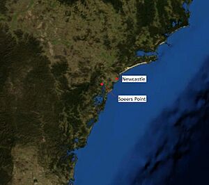
Speers Point is a lovely suburb located in Greater Newcastle, Australia. It's special because it's where the main offices for the City of Lake Macquarie council are! This town sits on the northern shore of Lake Macquarie, a big, beautiful lake. It's about 17 kilometers (11 miles) west-southwest of the city of Newcastle.
People first settled here in 1828. A coal mine opened in 1843, which helped the area grow. By 2006, about 3,230 people lived in Speers Point. There's even been an idea to rename part of the suburb to 'Lake Macquarie' to match the city's name.
Contents
History of Speers Point
Before Europeans arrived, the Awabakal people lived around Lake Macquarie. They called this area Biddaba or Milloba.
Early Settlement and Coal Mining
In 1828, a settler named William Brooks claimed land here. He called his property Lochend. In 1843, Brooks opened the Lochend Colliery, a coal mine. This mine dug for coal from the hills around what is now Speers Point.
How Speers Point Got Its Name
In 1870, a rich businessman from Sydney named William Speer moved to the area. He bought some of Brooks' land. Speer built his home across from where the Council Administration Centre is today. Over time, William Brooks' name for the area was forgotten. Instead, the area became known as Speers Point, named after William Speer. It refers to the piece of land that sticks out into Lake Macquarie.
Growth and Development
Speers Point started to grow more in 1902 when the first land was divided up for homes. More land was sold, and new businesses started. In 1910, Speers Point Park was given to the City of Lake Macquarie council.
In 1912, a steam tram line began operating, making it easier to travel. The City of Lake Macquarie council offices moved to Speers Point in 1915. A post office opened in 1916, along with another coal mine.
Transport and Services
In 1920, a boat service started to carry people across Cockle Creek. Later, in 1928, a footbridge was built, so people could walk across. The steam tram service stopped in 1930. However, private bus services started in 1931, and government bus routes began in 1937. Sewerage systems were installed in 1945, improving public health.
Schools and Important Events
Two public schools opened in January 1957 and January 1959. In 1945, a boat called Rani, built by the Steel brothers of Lake Macquarie, won the first ever Sydney to Hobart Yacht Race. This was a huge achievement!
The post office closed in 1976. In 1989, a big earthquake hit Newcastle. Speers Point suffered damage, especially to the local RSL club. The earthquake's center was very close, in the neighboring suburb of Boolaroo.
Geography of Speers Point
Speers Point is about 17 kilometers (11 miles) west-southwest of Newcastle, New South Wales. It's also about 143 kilometers (89 miles) north-east of Sydney. The suburb is part of the City of Lake Macquarie.
Where is Speers Point Located?
The borders of Speers Point are generally:
- Cockle Creek to the west.
- Seventh Street to the north.
- Fairfax Road to the east.
- Lake Macquarie to the south.
Speers Point is about 27 meters (89 feet) above sea level.
Climate in Speers Point
Speers Point has a humid subtropical climate. This means it has very warm and rainy summers. Winters are mild and drier, with cool nights. The hottest temperature ever recorded was 45.2 degrees Celsius (113.4 degrees Fahrenheit) in January 2013. The coldest was -3.4 degrees Celsius (25.9 degrees Fahrenheit) in July 2018.
| Climate data for Cooranbong (33º05'S, 151º28'E, 6 AMSL) (2008-2024 normals and extremes) | |||||||||||||
|---|---|---|---|---|---|---|---|---|---|---|---|---|---|
| Month | Jan | Feb | Mar | Apr | May | Jun | Jul | Aug | Sep | Oct | Nov | Dec | Year |
| Record high °C (°F) | 45.2 (113.4) |
42.5 (108.5) |
38.8 (101.8) |
34.6 (94.3) |
29.0 (84.2) |
25.4 (77.7) |
25.6 (78.1) |
29.3 (84.7) |
34.8 (94.6) |
37.1 (98.8) |
41.2 (106.2) |
43.0 (109.4) |
45.2 (113.4) |
| Mean daily maximum °C (°F) | 28.8 (83.8) |
28.0 (82.4) |
26.8 (80.2) |
24.3 (75.7) |
21.3 (70.3) |
18.5 (65.3) |
18.7 (65.7) |
19.9 (67.8) |
22.7 (72.9) |
24.3 (75.7) |
25.9 (78.6) |
27.4 (81.3) |
23.9 (75.0) |
| Mean daily minimum °C (°F) | 18.0 (64.4) |
17.4 (63.3) |
16.0 (60.8) |
12.0 (53.6) |
7.9 (46.2) |
6.6 (43.9) |
5.0 (41.0) |
5.1 (41.2) |
8.0 (46.4) |
11.0 (51.8) |
14.0 (57.2) |
16.0 (60.8) |
11.4 (52.5) |
| Record low °C (°F) | 8.8 (47.8) |
10.0 (50.0) |
7.1 (44.8) |
4.2 (39.6) |
−0.8 (30.6) |
−2.8 (27.0) |
−3.4 (25.9) |
−2.1 (28.2) |
0.6 (33.1) |
3.0 (37.4) |
5.7 (42.3) |
7.5 (45.5) |
−3.4 (25.9) |
| Average precipitation mm (inches) | 109.6 (4.31) |
138.4 (5.45) |
157.5 (6.20) |
93.9 (3.70) |
47.5 (1.87) |
94.5 (3.72) |
71.7 (2.82) |
48.7 (1.92) |
57.4 (2.26) |
89.8 (3.54) |
103.6 (4.08) |
88.2 (3.47) |
1,104.4 (43.48) |
| Average precipitation days (≥ 1.0 mm) | 8.4 | 10.1 | 10.6 | 9.2 | 6.3 | 8.7 | 6.3 | 4.6 | 6.1 | 8.6 | 8.1 | 9.1 | 96.1 |
| Source: Bureau of Meteorology (2008-2024 normals and extremes) | |||||||||||||
Economy and Industry
In the past, Speers Point was known for its coal mining. The Lochend Colliery operated from 1843 until 1916. Another mine, the Speers Point Gully mine, opened in 1916. There was also a dairy farm and a citrus orchard by the lake.
The Cockle Creek Smelter was a big industrial site nearby. It operated from 1896 but closed in 2003. Since then, Speers Point hasn't had any large industries.
Facilities and Activities
Speers Point gets the same news and media as nearby Newcastle. However, there's also a local newspaper called the Lake Macquarie News.
Sports and Recreation
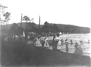
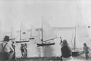
Even though it's a small suburb, Speers Point has many sports clubs. The Speers Point Amateur Sailing Club is very popular. It was started in the early 1900s and is still active today at Speers Point Park. Speers Point also has a swim center.
Speers Point Park
Right across from the swim center is Speers Point Park. This park is a great place for families. It has a stage area, fun playgrounds, and barbecue facilities. It's also a dog-friendly park.
Local Services
Speers Point has a branch of the RSL in nearby Boolaroo. There's also a bowls club close by. Speers Point doesn't have a hospital. However, there is a private hospital in the nearby suburb of Warners Bay.
Schools in Speers Point
Speers Point has one public school called Speers Point Public School. It's located on Bell Street and teaches students from Kindergarten to Year 6. The school opened in 1957. It has outdoor playgrounds, covered areas, sports facilities, and computer labs.
For high school, students in the area usually go to Lake Macquarie High School in nearby Booragul. There's also an independent school called St Pauls High School in Booragul.
People of Speers Point
In 2011, about 3,230 people lived in Speers Point. The average age of people in Speers Point was 44 years old. This is a bit older than the average for the wider Lake Macquarie area.
Most people in Speers Point were born in Australia (about 84.8%). The next most common birthplace was the United Kingdom.
The most common religions in Speers Point are Anglican, Roman Catholic, and Uniting. There are churches for these religions located in or near the suburb.
Getting Around Speers Point
Most people in Speers Point use cars to get to work. A state bike path also runs close to the suburb, which is great for cycling.
Some residents use public transport. The 363 bus route runs between Belmont/Warners Bay and Newcastle's city center. This bus also connects to the Main North railway line at Cockle Creek railway station, which is about 2.5 kilometers (1.6 miles) north of Speers Point. You can also take the bus to a major shopping center called Stockland Glendale.
In the past, Speers Point had steam trams from 1912 to 1930. There was also a rowing boat ferry service across Cockle Creek in 1920, before a footbridge was built in 1928. Government bus services started in 1937.
 | Mary Eliza Mahoney |
 | Susie King Taylor |
 | Ida Gray |
 | Eliza Ann Grier |


