
Northumberland County, New South Wales facts for kids
Quick facts for kids NorthumberlandNew South Wales |
|||||||||||||||
|---|---|---|---|---|---|---|---|---|---|---|---|---|---|---|---|

Location in New South Wales
|
|||||||||||||||
|
|||||||||||||||
Northumberland County was an important historical area in New South Wales, Australia. It was one of the first 19 counties created in the colony. Today, it is known as one of the 141 official land divisions in New South Wales.
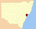
This county covered a large area north of Broken Bay. It included what we now call the Central Coast region and Lake Macquarie. It also stretched up to Newcastle in the Hunter area.
The county's borders were defined by rivers. To the south, it was bordered by part of the Hawkesbury River. The Macdonald River formed its border to the south-west. To the north, the Hunter River marked its boundary.
Contents
The Name Northumberland County
Northumberland County got its name from Northumberland, a county in England. It was named around 1804 by Lieutenant Charles Menzies. He was the commandant, or leader, at Newcastle at that time.
Northumberland County in the Past
By 1852, Northumberland County was quite large. It covered about 1,498,060 acres (6,062.4 km2) of land. At that time, around 15,207 people lived there. The county was about 68 miles (109 km) long and 53 miles (85 km) wide. It was known as the main area for coal mining in the colony.
Local Government in the County
For a period, Northumberland County had its own local government. This was called the Northumberland County Council. It operated from July 21, 1948, until December 19, 1963. This council helped manage local affairs for the county. It was ended at the same time as another similar council, the Cumberland County Council.
Images for kids
-
Location of Northumberland County in New South Wales
