Durham County, New South Wales facts for kids
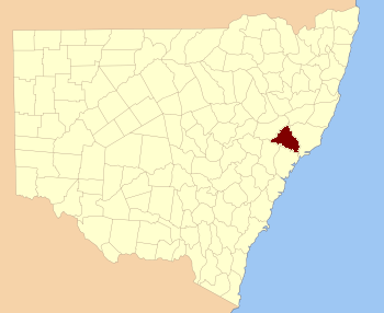
Quick facts for kids DurhamNew South Wales |
|||||||||||||||
|---|---|---|---|---|---|---|---|---|---|---|---|---|---|---|---|

Location in New South Wales
|
|||||||||||||||
|
|||||||||||||||
Durham County is a special kind of area in New South Wales, Australia. It's one of the original Nineteen Counties that were first set up in the early days of the colony. Today, it's known as a cadastral division, which means it's a defined area used for land records and mapping.
Durham County has natural borders. The Hunter River forms its southern and western edges. To the north and east, you'll find the Williams River. Some towns you might know within Durham County include Aberdeen and Muswellbrook.
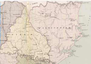
Before 1834, the area called Durham County was much bigger! It included places that later became Gloucester and most of Brisbane counties. It stretched all the way west to the Liverpool Range and east to the Pacific Ocean, even including Port Stephens. You can see this on old maps from 1832.
Who was Durham County named after?
Durham County was named to honor a very important person: John George Lambton. He was the First Earl of Durham, born in 1792 and passing away in 1840. Naming places after important figures was a common practice back then.
What are parishes?
Counties like Durham are divided into smaller areas called parishes. These parishes are also used for keeping track of land and property. Each parish has its own name and location, often linked to a local government area (LGA).
 | William L. Dawson |
 | W. E. B. Du Bois |
 | Harry Belafonte |


