Port Stephens (New South Wales) facts for kids
Quick facts for kids Port Stephens |
|
|---|---|
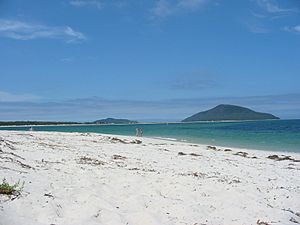
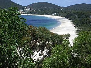
Looking towards Yacaaba, the northern headland at the entrance of Port Stephens, along Jimmys Beach from Winda Woppa
|
|
| Location | Hunter Region, New South Wales, Australia |
| Coordinates | 32°41′57″S 152°7′26″E / 32.69917°S 152.12389°E |
| Lake type | An open tide dominated drowned valley estuary |
| Primary inflows | Karuah River, Myall River, Tilligerry Creek |
| Primary outflows | Tasman Sea, South Pacific Ocean |
| Catchment area | 296.8 square kilometres (114.6 sq mi) |
| Basin countries | Australia |
| Designation | Marine park |
| Max. length | 24 km (15 mi) |
| Max. width | 6.5 km (4.0 mi) |
| Surface area | 134 square kilometres (52 sq mi) |
| Average depth | 14.1 metres (46 ft) |
| Water volume | 1,741,516.5 megalitres (61,501.07×106 cu ft) |
| Shore length1 | 113 km (70 mi) |
| Surface elevation | 0 m (0 ft) |
| Frozen | Never |
| Islands | 16 |
| Settlements | Anna Bay, Bobs Farm Bundabah, Carrington Corlette, Hawks Nest Karuah, Lemon Tree Passage Mallabula, Nelson Bay North Arm Cove, Oyster Cove Pindimar, Salamander Bay Soldiers Point, Shoal Bay Swan Bay, Tahlee Tanilba Bay, Taylors Beach Tea Gardens |
| 1 Shore length is not a well-defined measure. | |
Port Stephens is a huge natural harbour in New South Wales, Australia. It's like a big bay where the ocean meets rivers. This area is known as an estuary, which is a special place where fresh river water mixes with salty ocean water.
Port Stephens is part of the Port Stephens-Great Lakes Marine Park. It is located about 160 kilometres (99 mi) north-east of Sydney. The harbour is mainly within the Port Stephens local government area. However, its northern edge also forms a boundary with the Mid-Coast area.
In 2006, over 26,000 people lived close to its 113 km (70 mi) long shoreline. More than 32,000 people lived within 10 km (6 mi) of the harbour.
Contents
Discovering Port Stephens' Geography
Port Stephens is formed where the Myall and Karuah rivers, along with Tilligerry Creek, flow into the Tasman Sea. This sea is part of the South Pacific Ocean. The lower part of the harbour is mostly like the ocean, full of sea creatures. The upper part is more like a river mouth, with a mix of fresh and salt water.
The entrance to Port Stephens from the sea is narrow. It is marked by two impressive hills made from old volcanoes. The southern hill, called Tomaree or South Head, is 161 metres (528 ft) high. The northern hill, Yacaaba, is even taller at 210 m (690 ft). Most of the harbour is shallow and sandy. However, it has deep enough areas for large ships to sail through.
Port Stephens covers about 134 square kilometres (52 sq mi), making it bigger than Sydney Harbour. It stretches about 24 km (15 mi) inland from the Tasman Sea. At its widest point, it is 6.5 km (4 mi) across. The narrowest part is only 1.1 km (0.7 mi) wide.
- The Karuah River flows into Port Stephens in the north-west.
- The Myall River, coming from the Myall Lakes, enters the harbour on its northern side.
- Twelve Mile Creek flows into the harbour's south-western corner.
The southern shore of the port has two main areas: the Tomaree and Tilligerry peninsulas. These are separated by Tilligerry Creek. This creek drains water from low-lying areas like Salt Ash and Bobs Farm. The Tilligerry Peninsula is closer to big cities like Sydney. However, the Tomaree Peninsula has seen much more town development.
For example, Lemon Tree Passage and Soldiers Point are only 2.9 km (1.8 mi) apart by water. But because of the water and creeks, you have to drive almost 40 km (25 mi) to get from one to the other by road! The town of Karuah also has a similar situation.
The western and northern shores of the port are mostly undeveloped. They have scrubland and large areas of bushland. Closer to the sea, at Winda Woppa, you'll find sandy beaches. These beaches stretch for about 5.2 km (3.2 mi). Just outside the harbour's mouth are two small nature reserve islands: Cabbage Tree Island and Boondelbah Island. These islands protect the threatened Gould's petrel bird. No one is allowed to visit these islands.
Port Stephens' Past: A Look at History
Captain Cook named Port Stephens on May 11, 1770. He named it after Sir Philip Stephens, who was a friend and an important person in the navy.
The first ship to enter the port was the Salamander in 1791. This ship was part of the Third Fleet that brought convicts to Australia. The suburb of Salamander Bay is named after this ship. In the same year, escaped convicts found coal in the area.
In 1795, a ship's crew found a group of escaped convicts living with the local Worimi people. Because Port Stephens became a hiding place for escaped convicts, soldiers were sent there in 1820. The place where they set up camp is now called Soldiers Point.
A small ship called the Lambton started shipping timber and wool from the port in 1816. The suburb of Corlette is named after the ship's captain, James Corlette.
Port Stephens generally has poor soil, so it wasn't good for farming. This is why no big towns grew there historically. The major city and port of Newcastle developed instead, about 45 km (28 mi) south-west of Port Stephens.
Despite this, in 1920, some people wanted Port Stephens to be the capital city of a new state. This idea came from a newspaper editor who felt that country towns were being ignored by the government in Sydney.
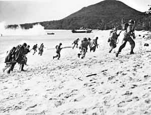
During World War II, the Royal Australian Navy set up a training base called HMAS Assault at Nelson Bay. This base was used to train soldiers for amphibious landings (landings from the sea). The old sick bay from HMAS Assault is still standing and is now used as an arts centre.
Over time, small towns grew around the port. These were places for fishing, holidays, and retirement. Since the 1970s, it has become easier to travel from Sydney. This, along with more people wanting to retire by the coast, has led to a lot of growth in these towns.
Port Stephens-Great Lakes Marine Park: Protecting Sea Life
On December 1, 2005, the Port Stephens-Great Lakes Marine Park was created. This park covers about 97,200 hectares (240,000 acres). It includes all of Port Stephens, the Karuah and Myall rivers, and all their creeks that are affected by tides. The park was made to protect the many different kinds of sea life that live in the port and nearby coastal areas. These areas stretch from south of Forster to the northern end of Stockton Beach.
Who Lives Around Port Stephens?
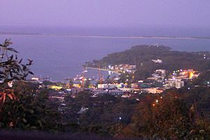
In 2006, most people living around Port Stephens lived on or near the southern shores. More than 22,188 people lived very close to the port. These areas include Corlette, Lemon Tree Passage, Nelson Bay, and Salamander Bay. Another 5,343 people lived a bit further away, but still within 10 km (6 mi) of the port.
Most of the towns and development on the southern side of Port Stephens are on the Tomaree peninsula. These include popular places like Nelson Bay and Shoal Bay.
On the western shore, there's a small community called Swan Bay. About 100 people live there. The main business in this area is oyster farming. There is also a small tourist resort. The town of Karuah, with a population of 857, is at the north-western corner of the port.
East of the Karuah River, in the Mid-Coast Council area, about 3,584 people live. These towns include Hawks Nest and Tea Gardens.
Fun Things to Do: Tourism and Recreation
Port Stephens is a very popular place for tourists. People love to visit for activities on the water.
 | William L. Dawson |
 | W. E. B. Du Bois |
 | Harry Belafonte |


