Spinner Island facts for kids

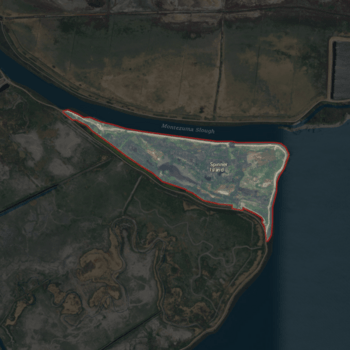
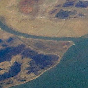
USGS aerial imagery of Spinner Island. Van Sickle Island can be seen to the southwest.
|
|
| Geography | |
|---|---|
| Location | Northern California |
| Coordinates | 38°04′11″N 121°52′10″W / 38.06972°N 121.86944°W |
| Adjacent bodies of water | Sacramento–San Joaquin River Delta |
| Highest elevation | 0 ft (0 m) |
| Administration | |
|
United States
|
|
| State | |
| County | Solano |
Spinner Island is a small piece of land located in Suisun Bay. This bay is a part of the larger San Francisco Bay in Northern California. Spinner Island is found where the Sacramento and San Joaquin Rivers flow into the bay.
The island is part of Solano County. It is not managed by a special "reclamation district." These districts usually help manage water and land in delta areas.
What is Spinner Island?
Spinner Island is a flat island in the water. The United States Geological Survey (USGS) measured its height in 1981. They found it is at 0 feet above sea level. This means it is very low and close to the water's surface. Its exact location is 38°04′11″N 121°52′10″W / 38.06972°N 121.86944°W.
Where is Spinner Island Located?
Spinner Island sits in Suisun Bay. This bay is like a large water area that connects the rivers to the bigger San Francisco Bay. The Sacramento–San Joaquin River Delta is a huge area where two major rivers, the Sacramento and San Joaquin, meet. They then flow into Suisun Bay and eventually into the Pacific Ocean. Spinner Island is right in the middle of this important water system.
A Look Back in Time
Spinner Island has been on maps for a long time. It was shown on a survey map made in 1850. This map was created by Cadwalader Ringgold. He was an important person who mapped the San Francisco Bay area. The island also appeared on another map from 1854. This one was made by Henry Lange. Even though it wasn't always labeled with its name, its shape was there. This shows that Spinner Island has been a part of the landscape for many years.
 | Misty Copeland |
 | Raven Wilkinson |
 | Debra Austin |
 | Aesha Ash |


