Split Rock River facts for kids
Quick facts for kids Split Rock River |
|
|---|---|

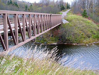
The Gitchi-Gami State Trail crossing near the mouth of the Split Rock River
|
|
|
Mouth of the Split Rock River
|
|
| Country | United States |
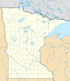
| State | Minnesota |
| County | Lake County |
| Physical characteristics | |
| Main source | Legler Lake, Silver Creek Township 1,020 ft (310 m) 47°21′43″N 91°33′14″W / 47.3618646°N 91.5537776°W |
| River mouth | Lake Superior at Silver Creek Township 47°10′55″N 91°24′28″W / 47.18194°N 91.40778°W |
| Length | 3.5-mile-long (5.6 km) |
| Basin features | |
| Basin size | 40 sq mi (100 km2) |
The Split Rock River is a short river in Minnesota, United States. It is about 3.5-mile-long (5.6 km). This river flows into Lake Superior. It drains a small area of land, called a watershed, which is about 40 square miles (100 km2) big. This watershed is located on the North Shore of Lake Superior.
People have used the name "Split Rock River" since at least 1825. The name likely comes from the river's deep, narrow valley. It might also refer to two cliffs near the river's mouth that look like they have been split apart. The native people had their own name for the river: Gininwabiho-zibi. This means "War Eagle Iron River." The lower part of the river flows through Split Rock Lighthouse State Park. The Superior Hiking Trail follows both sides of the river. There is also another stream nearby called Split Rock Creek.
River's Journey and Waterfalls
The Split Rock River starts with two branches, the East and West Split Rock River. These branches begin in wet, marshy areas near Legler Lake. The two branches meet about 3.5 miles (5.6 km) before the river reaches Lake Superior.
Over the next two miles (3 km), the river drops about 110 feet (34 m) in height. Then, it drops another 350 feet (110 m) over the next mile. In its last mile, the river becomes flatter and slower. Finally, it empties into Lake Superior.
The river has ten waterfalls! However, they are not easy to reach. You need to take a moderate hike on the Superior Hiking Trail to see them. Because of this, not many people visit these hidden waterfalls.
History of the River Area
From 1899 to 1906, the area around the Split Rock River was used for logging. Loggers cut down many red and white pine trees. There was even a town called Splitrock, Minnesota right at the river's mouth. A 10-mile-long (16 km) railway line was built to carry the cut lumber down to the lake.
A very strong storm, called the Mataafa Storm, hit on November 28, 1905. During this storm, seven ships were wrecked within a few miles of the Split Rock River. One of these ships, the steel steamboat William Edenborn, was wrecked right at the river's mouth. This big storm and the shipwrecks led to the building of the famous Split Rock Lighthouse on a nearby cliff.
 | Valerie Thomas |
 | Frederick McKinley Jones |
 | George Edward Alcorn Jr. |
 | Thomas Mensah |


