Split Rock Lighthouse State Park facts for kids
Quick facts for kids Split Rock Lighthouse State Park |
|
|---|---|
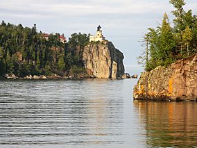
Split Rock Lighthouse State Park seen from the shore of Lake Superior
|
|
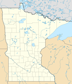
| Location | Lake, Minnesota, United States |
| Area | 2,200 acres (8.9 km2) |
| Elevation | 728 ft (222 m) |
| Established | 1945 |
| Named for | Split Rock Lighthouse |
| Governing body | Minnesota Department of Natural Resources |
Split Rock Lighthouse State Park is a beautiful state park in Minnesota. It is located right on the North Shore of Lake Superior. The park is most famous for the amazing Split Rock Lighthouse. This lighthouse is one of the most photographed lighthouses in the United States.
The United States Lighthouse Service built the lighthouse in 1910. Today, the Minnesota Historical Society runs the lighthouse and nearby buildings as a museum. This 2,200-acre state park has a special "cart-in" campground. It also offers scenic trails for hiking, cross-country skiing, and bicycling.
Contents
Park Geography and Geology
Park Geography
Split Rock Lighthouse State Park has about 4 miles of rocky shoreline on Lake Superior. There are several big points of land sticking out into the lake. Some of these famous spots include Split Rock Point, Corundum Point, and Stony Point. The lighthouse sits on Stony Point.
There's a place called Little Two Harbors. It got its name because a small island divides the inlet. This makes it look like two small harbors, similar to the city of Two Harbors down the shore. You can also find two shallow sea caves at the base of Stony Point.
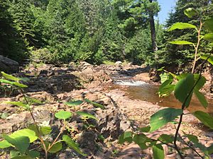
The park also has the Split Rock River, which has two branches. These branches meet inside the park. There are ten waterfalls on the river. They are a bit hidden, so not many people visit them.
Park Geology
The shore of Lake Superior is mostly made of a rock called basalt. This rock formed 1.1 billion years ago when the middle of the North American Plate started to crack. In the area of Split Rock Lighthouse State Park, hot liquid rock (magma) pushed into the basalt. This magma cooled underground and formed a harder rock called diabase.
This magma also carried huge pieces of anorthosite. Anorthosite is an even harder rock from deep inside the Earth's crust. These pieces are mixed randomly within the diabase. Three large blocks of anorthosite form Corundum Point, Day Hill, and Stony Point (where the lighthouse is). In the park's southwest part, another eruption formed a layer of red rhyolite. This rhyolite has worn away into cool natural pillars. It also forms the walls of the Split Rock River gorge.
About 2 million years ago, many ice ages covered the region. Huge glaciers moved across the land. They scraped away the bedrock and dug out the big basin that became Lake Superior. The glaciers wore away softer rocks, leaving behind hills and ridges of the harder diabase and anorthosite. After the last ice age, the basin filled with meltwater. The water levels changed a lot over time. High water levels created Glacial Lake Duluth, which left clay sediments inland. Later, lower water levels carved out bluffs and beach terraces.
Plants and Animals
The park used to have many red and white pine trees. But at the start of the 1900s, most of these trees were cut down. Wildfires then swept through the cut areas, killing many young trees. Today, the park mainly has birch trees, along with some spruce, fir, and ash trees.
You can find many mammals in the park. These include white-tailed deer, moose, black bears, raccoons, snowshoe hares, red foxes, bobcats, and Canadian lynxes. A group of beavers lives on the Split Rock River. Many birds also live here, like herring gulls, common loons, and various songbirds. Peregrine falcons build their nests on the cliffs by the lake.
Park History and the Lighthouse
Early History of the Area
You can still see signs of early 1900s industries in the park. The first white settlement here was Little Two Harbors. It was a fishing village, mostly settled by people from Norway. The fishermen caught trout, whitefish, and herring. They fished from small boats in the fall and winter. People lived in Little Two Harbors until 1925. Today, you can still see the cement foundations of houses and fish processing buildings.
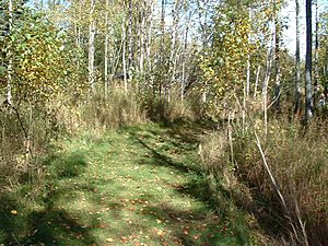
A logging camp called Splitrock was at the mouth of the Split Rock River from 1899 to 1906. You can still see wooden pilings from their dam and wharf sticking out of the water. The Merrill Logging Trail follows the path of their 10-mile rail line.
In 1901, a person from Duluth thought the rocks of anorthosite were corundum. Corundum is a very hard mineral used for grinding. Three years later, the North Shore Abrasives Company started mining on Corundum Point. But they left the site in 1908 because their product wasn't good enough. Their crushing building burned down in a forest fire in 1910, but its concrete foundations are still there.
Another interesting leftover from this time is a beautiful stone fireplace on top of Day Hill. People say that a businessman from Duluth named Frank Day built it around 1900. He planned to build a house there for himself and someone he loved. But he stopped building when she didn't love him back.
Building the Split Rock Lighthouse
In November 1905, three very bad storms hit the Great Lakes. These storms killed 116 sailors. One storm, the Mataafa Storm, damaged almost 30 ships on Lake Superior. Two ships were wrecked near the future park's shore. These were the steel steamboat William Edenborn and a barge it was pulling, the Madeira.
The Edenborn ended up far ashore at the mouth of the Split Rock River. It was later saved, but one of its 25 crew members died. The Madeira had 10 men on board. It drifted northeast until huge waves started smashing it against the cliffs of Gold Rock Point. A crewman named Fred Benson managed to jump onto the rocks and climb the cliff during the snowstorm. The first mate was swept overboard and drowned. But Benson was able to lower a rope and pull the other eight crew members to safety. The Madeira broke apart and sank at the bottom of Gold Rock Point. The crew members, suffering from cold and frostbite, found shelter with local fishermen and loggers. Both crews were rescued two days later by a tugboat called Edna G.
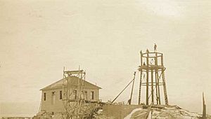
After these storms, shipping companies asked the government for more navigational aids on the Great Lakes. The area near the Split Rock River was a top priority. The lighthouse and fog signal were built on Stony Point, about 2.5 miles northeast of the Split Rock River. There were no roads along the North Shore yet. So, all building materials came by barge. Workers used a derrick and a steam-powered hoist to lift everything up the cliff. By mid-1910, the lighthouse, foghorn building, and three houses for the lighthouse keepers were finished.
The derrick was the only way to get supplies up the cliff until the lighthouse staff built a tramway in 1915-16. The station finally became reachable by road, now Minnesota State Highway 61, in 1929. Five years later, a crew from the Civilian Conservation Corps built a new access road. Lighthouse workers then used a truck to bring in supplies by land, so the tramway was taken apart.
The beautiful lighthouse, sitting on a 130-foot cliff, started attracting visitors very quickly. When Highway 61 was finished, even more tourists came. In 1938, about 100,000 visitors stopped by. This was five times more than any other federal lighthouse. Some of the lighthouse keepers' children even opened a souvenir stand in 1941. Both the U.S. Lighthouse Service and the U.S. Coast Guard (which took over in 1939) had to hire extra staff to help with tours.
Creating the State Park
In 1945, Clarence R. Magney, a judge from Duluth, saw a sign that said "Lake and River Frontages for Sale." He wanted to protect land on the North Shore from being built on. At that time, Gooseberry Falls was the only Minnesota state park on Lake Superior. A bill supported by Magney easily passed in the Minnesota Legislature. This created Baptism River State Park (now Tettegouche State Park) and Split Rock State Scenic Wayside. The 35-acre wayside was a hill with a view of the Split Rock Lighthouse.
Because it was so popular, the lighthouse kept working even after new technology like radar made it less needed. But by 1967, the Coast Guard thought about closing the station. The state legislature decided to make the wayside into a full state park, including the lighthouse itself. The station officially closed in 1969 after 59 years of service. The land and buildings were given to the state of Minnesota for free. The state would run them as a historic site.
The state parks division built an entrance station, picnic areas, roads, and trails. The Minnesota Historical Society took over managing the lighthouse station in 1976. They restored several buildings to look like they did in the 1920s. They also built a $1.2 million history center. From 1984 to 1990, the state park spent $555,000 to improve fun activities. This included a new access road, picnic area, and an expanded trail system. They also built the park's first campground. It was unique because campers use carts to wheel their gear to their sites.
Gold Rock Point, the land just north of the lighthouse, was not part of the park at first. In 1997, the Parks & Trails Council of Minnesota bought it from its private owners. This group was started by Clarence Magney and others to buy land and hold it until the state could make it public. The next year, Nadine Blacklock, a nature photographer, died in a car accident just outside the park's north end. The Council and the Blacklock Nature Sanctuary bought 80 acres of land around the accident site. 43 acres were given to the state park. The rest, with a cabin, is managed by the Blacklock Nature Sanctuary as a place for artists to stay. These additions helped create access for divers to the Madeira wreck and for the Gitchi-Gami State Trail, a paved bike path along the North Shore.
Fun Things to Do
Split Rock Lighthouse State Park has a special "cart-in" campground. It has 20 private campsites and a modern restroom. Campers park their cars and use two-wheeled carts provided by the park. They carry their gear a short distance to their campsite. There are also four backpack campsites along the shore. Two of these are for people using sea kayaks. Other campgrounds are available in nearby state forests. The park plans to add 60 drive-in campsites in the future.
The park has 14.5 miles of trails for hiking, bicycling, and cross-country skiing. There are several spots where you can get great views of the lighthouse and Lake Superior. A paved part of the Gitchi-Gami State Trail runs through the park near the shore. The Superior Hiking Trail goes inland and follows both the Split Rock River and Split Rock Creek. There is a picnic area by the lake and two picnic shelters. One shelter is open all year.
You can also enjoy water activities like boating, sea kayaking, and fishing. You can fish for lake trout, salmon, and brown trout. The park also lets scuba divers explore the Madeira wreck. The wreck is listed on the National Register of Historic Places. Divers can also see parts of the Madeira in Little Two Harbors. These parts were dumped there in 1974 after a failed attempt to save them. You can also see underwater items from the old settlements of Splitrock and Little Two Harbors in their bays.
Park Events
The park's trail center hosts many public events. These include music shows, nature walks, and history programs. Every year on November 10th, the lighthouse beacon is lit. This is to remember the sunken ship SS Edmund Fitzgerald. About 900 people come to this event each year.
 | Mary Eliza Mahoney |
 | Susie King Taylor |
 | Ida Gray |
 | Eliza Ann Grier |


