
Springdale, Pennsylvania facts for kids
Quick facts for kids
Springdale, Pennsylvania
|
|
|---|---|
|
Borough
|
|
 |
|
| Nickname(s):
Power City
|
|

Location in Allegheny County and the U.S. state of Pennsylvania.
|
|

Springdale, Pennsylvania
Location in Pennsylvania

Springdale, Pennsylvania
Location in the United States
|
|
| Country | United States |
| State | Pennsylvania |
| County | Allegheny |
| First settled | 1730 |
| Incorporated | Oct 17, 1906 |
| Area | |
| • Total | 1.09 sq mi (2.83 km2) |
| • Land | 0.93 sq mi (2.42 km2) |
| • Water | 0.16 sq mi (0.42 km2) |
| Elevation | 814 ft (248 m) |
| Population
(2020)
|
|
| • Total | 3,400 |
| • Density | 3,640.26/sq mi (1,406.07/km2) |
| Time zone | UTC-5 (Eastern (EST)) |
| • Summer (DST) | UTC-4 (EDT) |
| ZIP code |
15144
|
| Area code(s) | 724 |
| School district | Allegheny Valley |
Springdale is a small town, called a borough, in Pennsylvania. It's located in the northeast part of Allegheny County, about 18 miles (29 km) northeast of Pittsburgh. The town sits along the Allegheny River. In 2020, about 3,400 people lived there. Springdale officially became a borough in 1906. This happened after it separated from the larger Springdale Township.
Contents
History of Springdale
Springdale Borough was officially created in 1906. It got its name from the natural springs and the small valley, or "dale," nearby. Before this, the area was home to Native American tribes. Later, European settlers arrived.
The town became busy in the late 1800s and early 1900s. It was an important railroad town and a center for the coal industry. The name "Springdale" was first used around 1820. People believe Hannah Keene or her daughter, Frances, named it. Before that, the town might have been known as "Deertown." Today, Springdale is a quiet place to live. It has a small downtown area with many local businesses.
Early Settlers
The first European settlers came to the Springdale area in the early 1800s. Some well-known families who settled there included Pillow, Coe, Remaley, Henderson, Mellon, Brackenridge, Denny, Hanna, Keene, Shoop, and Moyer. Many streets in Springdale today are named after these early families.
Geography
Springdale is located at coordinates 40.5409 degrees North and 79.7839 degrees West.
The U.S. Census Bureau says the borough covers about 1.1 square miles (2.8 square kilometers). Most of this area, about 0.9 square miles (2.3 square kilometers), is land. The rest, about 0.2 square miles (0.5 square kilometers), is water.
Local Streams
The Riddle Run is a stream that flows into the Allegheny River right in Springdale. Another stream, the Tawney Run, flows between Springdale and a nearby town called Cheswick.
Neighboring Communities
Springdale shares its borders with two other places. To the north, it borders Springdale Township. To the west, it borders Cheswick. Across the Allegheny River, to the east and south, is the town of Plum.
Population Facts
| Historical population | |||
|---|---|---|---|
| Census | Pop. | %± | |
| 1880 | 456 | — | |
| 1910 | 1,999 | — | |
| 1920 | 2,929 | 46.5% | |
| 1930 | 4,781 | 63.2% | |
| 1940 | 4,989 | 4.4% | |
| 1950 | 4,939 | −1.0% | |
| 1960 | 5,602 | 13.4% | |
| 1970 | 5,202 | −7.1% | |
| 1980 | 4,418 | −15.1% | |
| 1990 | 3,992 | −9.6% | |
| 2000 | 3,828 | −4.1% | |
| 2010 | 3,405 | −11.1% | |
| 2020 | 3,400 | −0.1% | |
| U.S. Decennial Census | |||
In 2000, there were 3,828 people living in Springdale. These people lived in 1,685 households, and 1,034 of these were families. The population was mostly White (99.03%).
About 21.9% of the people were under 18 years old. About 20.5% were 65 years or older. The average age in Springdale was 41 years old.
The average income for a household in Springdale was $35,440. For families, the average income was $43,476. About 7.8% of the total population lived below the poverty line. This included 10.2% of those under 18.
Places to Visit
The Springdale Free Public Library is a place where people can borrow books and use other resources.
The Rachel Carson Homestead is also located in Springdale. This is the childhood home of Rachel Carson. She was a famous marine biologist and writer.
Springdale is also near some industrial sites. One is a PPG plant, which makes paints and coatings. It celebrated its 75th anniversary in 2022. Another was the Cheswick Generating Station. This was a power plant that used coal. It had two very tall smokestacks that could be seen for miles. These smokestacks were taken down in June 2023.
Education
Students in Springdale attend schools in the Allegheny Valley School District. The borough is served by Springdale Jr-Sr High School. This school teaches both junior high and high school students. The former Colfax Upper Elementary School building is also in Springdale.
Gallery
-
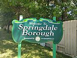
Springdale Welcome sign
-
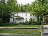
Rachel Carson Homestead in May 2007
-
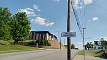
Uphill view of Springdale Jr-Sr High School


Notable People
- Rachel Carson — A famous marine biologist and writer. She wrote the important book Silent Spring.
- Conrad Susa — A well-known composer of operas. He studied at the Juilliard School.
- Tony Janiro — An American middleweight boxer.
See also
 In Spanish: Springdale (Pensilvania) para niños
