St. Charles, Michigan facts for kids
Quick facts for kids
St. Charles, Michigan
|
|
|---|---|
|
Village
|
|

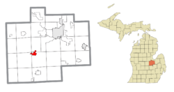
Location within Saginaw County
|
|
| Country | United States |
| State | Michigan |
| County | Saginaw |
| Townships | Brant, St. Charles, and Swan Creek |
| Government | |
| • Type | Village council |
| Area | |
| • Total | 2.17 sq mi (5.62 km2) |
| • Land | 2.09 sq mi (5.42 km2) |
| • Water | 0.07 sq mi (0.20 km2) |
| Elevation | 604 ft (184 m) |
| Population
(2020)
|
|
| • Total | 1,992 |
| • Density | 951.74/sq mi (367.48/km2) |
| Time zone | UTC-5 (Eastern (EST)) |
| • Summer (DST) | UTC-4 (EDT) |
| ZIP code(s) |
48655
|
| Area code(s) | 989 |
| FIPS code | 26-70640 |
| GNIS feature ID | 2399159 |
St. Charles is a small village located in Saginaw County, in the state of Michigan, United States. It is found in the northwest part of St. Charles Township. Some parts of the village also extend into Brant and Swan Creek townships. In 2010, the village had a population of 2,054 people.
Contents
Geography of St. Charles
St. Charles covers a total area of about 2.20 square miles (5.70 square kilometers). Most of this area, about 2.12 square miles (5.49 square kilometers), is land. The remaining 0.08 square miles (0.21 square kilometers) is water. The Bad River flows right through the village of St. Charles.
Population and People
| Historical population | |||
|---|---|---|---|
| Census | Pop. | %± | |
| 1900 | 1,317 | — | |
| 1910 | 1,451 | 10.2% | |
| 1920 | 1,469 | 1.2% | |
| 1930 | 1,463 | −0.4% | |
| 1940 | 1,300 | −11.1% | |
| 1950 | 1,469 | 13.0% | |
| 1960 | 1,959 | 33.4% | |
| 1970 | 2,046 | 4.4% | |
| 1980 | 2,276 | 11.2% | |
| 1990 | 2,144 | −5.8% | |
| 2000 | 2,215 | 3.3% | |
| 2010 | 2,054 | −7.3% | |
| 2020 | 1,992 | −3.0% | |
| U.S. Decennial Census | |||
The average income for a household in St. Charles was $50,183. This is based on information from the United States Census Bureau.
St. Charles in 2010
According to the 2010 census, 2,054 people lived in St. Charles. There were 864 households and 550 families. This means there were about 969 people living in each square mile (374 people per square kilometer).
There were 928 homes in the village. On average, there were about 438 homes per square mile (169 homes per square kilometer).
Most of the people in the village were White (97.0%). Other groups included African American (0.9%), Native American (0.7%), and Asian (0.1%). About 1.1% of people were from two or more races. People of Hispanic or Latino background made up 5.2% of the population.
Out of the 864 households, 30.6% had children under 18 living with them. About 43.4% were married couples living together. Some households (14.9%) had a female head without a husband. About 5.3% had a male head without a wife. The remaining 36.3% were not families.
About 30.6% of all households had only one person living in them. Of these, 14.5% were people aged 65 or older living alone. The average household had 2.36 people. The average family had 2.93 people.
The average age of people in the village was 38.7 years. About 24.1% of residents were under 18 years old. About 9.3% were between 18 and 24. People aged 25 to 44 made up 23.9% of the population. Those aged 45 to 64 were 26.7%. Finally, 16.1% of residents were 65 years or older. The village had slightly more females (51.6%) than males (48.4%).
Climate in St. Charles
St. Charles experiences a climate with big changes in temperature throughout the year. Summers are usually warm to hot, and sometimes humid. Winters are cold, and can be very cold at times. This type of weather is known as a humid continental climate. On climate maps, it is often shown as "Dfb" according to the Köppen Climate Classification system.
See also
 In Spanish: St. Charles (Míchigan) para niños
 | Delilah Pierce |
 | Gordon Parks |
 | Augusta Savage |
 | Charles Ethan Porter |


