St. Clair Township, Michigan facts for kids
Quick facts for kids
St. Clair Township, Michigan
|
|
|---|---|

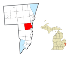
Location within St. Clair County
|
|
| Country | United States |
| State | Michigan |
| County | St. Clair |
| Area | |
| • Total | 39.6 sq mi (102.5 km2) |
| • Land | 39.0 sq mi (100.9 km2) |
| • Water | 0.6 sq mi (1.7 km2) |
| Elevation | 623 ft (190 m) |
| Population
(2020)
|
|
| • Total | 7,085 |
| • Density | 178.91/sq mi (69.12/km2) |
| Time zone | UTC-5 (Eastern (EST)) |
| • Summer (DST) | UTC-4 (EDT) |
| ZIP code(s) |
48040, 48079
|
| Area code(s) | 810 |
| FIPS code | 26-70700 |
| GNIS feature ID | 1627025 |
St. Clair Township is a special kind of local government area called a civil township. It is located in St. Clair County, in the state of Michigan, United States. In 2020, about 7,085 people lived here. The city of St. Clair is very close to the southeast part of the township.
Contents
Exploring St. Clair Township's Communities
St. Clair Township has different areas within it. One of these is a small, undeveloped community.
Discover Rattle Run
- Rattle Run is a small, undeveloped area in the western part of the Township. It is located where Gratiot Avenue and Rattle Run Road meet. This spot is about 630 feet (192 meters) above sea level.
How St. Clair Township Got Its Name
The name "St. Clair" has a cool history! It comes from the St. Clair River, which flows next to the township. The river itself was named after Lake Saint Clair.
The Story Behind the Lake's Name
French explorers, led by René Robert Cavelier, Sieur de La Salle, entered the lake on August 12, 1679. This day was a special feast day for Saint Clare of Assisi. So, they named the lake Lac Sainte-Claire.
From French to English Spelling
English maps started showing the lake as "Saint Clare" as early as 1710. By 1755, maps like the Mitchell Map used the spelling we see today: "St. Clair."
Connecting Names: General St. Clair and Fort Sinclair
Some people think the name honors Arthur St. Clair, a general from the American Revolutionary War. However, the name "St. Clair" was used long before he became famous. It's possible that the lake's name and the general's name got mixed up. This might have led to places like St. Clair County and the cities of St. Clair and St. Clair Shores getting their names.
Another person sometimes linked to the name is Patrick Sinclair. He was a British officer who bought land on the St. Clair River. In 1764, he built Fort Sinclair there, which was used for almost 20 years.
St. Clair Township's Geography
St. Clair Township covers a total area of about 39.6 square miles (102.5 square kilometers). Most of this area, about 39.0 square miles (100.9 square kilometers), is land. The rest, about 0.6 square miles (1.7 square kilometers), is water.
Understanding the People of St. Clair Township: Demographics
A census is like a big count of all the people living in an area. The 2000 census helped us learn about the people in St. Clair Township.
Population and Households
In 2000, there were 6,423 people living in the township. These people lived in 2,266 different homes, called households. About 1,828 of these households were families. The average number of people in a household was 2.83, and for families, it was 3.17.
Age Groups in the Township
The population in the township was spread out across different age groups:
- About 27.7% of the people were under 18 years old.
- About 7.3% were between 18 and 24 years old.
- About 29.1% were between 25 and 44 years old.
- About 25.1% were between 45 and 64 years old.
- About 10.8% were 65 years old or older.
The average age of people in the township was 38 years.
Income and Economy
The median income for a household in the township was $58,711. This means that half of the households earned more than this amount, and half earned less. For families, the median income was $65,924. The average income per person in the township was $24,705. A small number of families (2.5%) and people (3.2%) lived below the poverty line, which means they had very low incomes.
See also
 In Spanish: Municipio de St. Clair (Míchigan) para niños
 | Misty Copeland |
 | Raven Wilkinson |
 | Debra Austin |
 | Aesha Ash |


