
St Martin's, Isles of Scilly facts for kids
Quick facts for kids St Martin's
|
|
|---|---|
 The north coast |
|

St Martin's
|
|
| Population | 136 (2011) |
| OS grid reference | SV 925 159 |
| Civil parish |
|
| Unitary authority | |
| Ceremonial county | |
| Region | |
| Country | England |
| Sovereign state | United Kingdom |
| Post town | ISLES OF SCILLY |
| Postcode district | TR25 |
| Dialling code | 01720 |
| Police | Devon and Cornwall |
| Fire | Isles of Scilly |
| Ambulance | South Western |
| EU Parliament | South West England |
| UK Parliament |
|
St Martin's is a beautiful island in England, part of the Isles of Scilly. Its Cornish name, Brechiek, means "dappled island." It's the most northern island where people live, and it covers about 2.37 square kilometers (0.92 square miles).
Contents
Discover St Martin's Island

St Martin's has three main villages: Higher Town, Middle Town, and Lower Town. You'll also find scattered farms and cottages. In 2011, about 136 people lived here.
The island has two places for boats to dock. The Higher Town Quay is used when the tide is high. The Hotel Quay at Lower Town is used when the tide is low. Higher Town also has a post office.
Did you know there's a vineyard on the island? It's a place where grapes are grown to make wine!
To the north, St Martin's is connected to White Island by a path that appears at low tide.
The Famous Daymark

At the northeast tip of the island stands a tall, red-and-white tower called a daymark. It was built in 1683 by Thomas Ekins. He was the first person from the Godolphin family to manage the islands.
The daymark is a round tower made of granite. It's about 4.8 meters (16 feet) wide and 11 meters (36 feet) tall. An old door on the tower has the wrong date, 1637. It used to be painted white until 1822. By 1833, it was red, and now it has red and white stripes.
Even though it's quite old, the daymark is a special historical site. It's protected like ancient monuments.
The daymark is on the highest point of St Martin's. It's also the second-highest spot in all the Isles of Scilly. Because it's so high, you can often see the mainland of Cornwall from here on clear days. People on the mainland can also spot the daymark!
Places of Worship
St Martin's has two churches. The Anglican parish church of St Martin's and St Martin's Methodist Church are both in the Higher Town area. The Methodist chapel was built around 1845. It's part of the Isles of Scilly Methodist Circuit.
Education on the Island
Younger students on St Martin's attend the St Martin's Base. This is a primary school campus of the Five Islands Academy.
Older students, who are in secondary school, live and study at the main campus. This campus is on St Mary's island during the week. They travel back to St Martin's on weekends.
Students who are older than secondary school age usually go to colleges on mainland Great Britain.
Island Population Over Time
Here's how the number of people living on St Martin's has changed over many years:
- 1841 - 214 people
- 1861 - 185 people
- 1871 - 158 people
- 1881 - 175 people
- 1891 - 174 people
- 1901 - 175 people
- 1911 - 191 people
- 1921 - 134 people
- 1931 - 134 people
- 1951 - 131 people
- 1961 - 118 people
- 1971 - 106 people
- 1981 - 118 people
- 1991 - 110 people
- 2001 - 142 people
- 2011 - 136 people
Images for kids
-
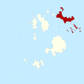
A map showing St Martin's in red.

