Stanley, Louisiana facts for kids
Quick facts for kids
Stanley, Louisiana
|
|
|---|---|
|
Village
|
|
| Village of Stanley | |

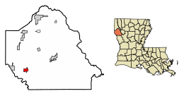
Location of Stanley in De Soto Parish, Louisiana.
|
|

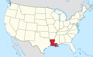
Location of Louisiana in the United States
|
|
| Country | United States |
| State | Louisiana |
| Parish | DeSoto |
| Area | |
| • Total | 2.19 sq mi (5.68 km2) |
| • Land | 2.17 sq mi (5.62 km2) |
| • Water | 0.02 sq mi (0.05 km2) |
| Elevation | 312 ft (95 m) |
| Population
(2020)
|
|
| • Total | 132 |
| • Density | 60.80/sq mi (23.47/km2) |
| Time zone | UTC-6 (CST) |
| • Summer (DST) | UTC-5 (CDT) |
| Area code(s) | 318 |
| FIPS code | 22-72800 |
Stanley is a small village located in DeSoto Parish, Louisiana, in the United States. In 2010, about 107 people lived there. This was a bit less than the 145 people who lived there in 2000. Stanley is also part of the larger Shreveport and Bossier City area, which is a big group of towns and cities close together.
Contents
Where is Stanley Located?
Stanley is found in the western part of DeSoto Parish. A main road, U.S. Route 84, goes right through the middle of the village. If you go west on this road for about 6 miles (10 km), you'll reach Logansport. If you travel northeast for about 14 miles (23 km), you'll get to Mansfield, which is the main town of the parish.
The village of Stanley covers a total area of about 2.19 square miles (5.7 square kilometers). Only a tiny part of this area, about 0.02 square miles (0.05 square kilometers), is water.
How Many People Live in Stanley?
| Historical population | |||
|---|---|---|---|
| Census | Pop. | %± | |
| 1960 | 234 | — | |
| 1970 | 145 | −38.0% | |
| 1980 | 151 | 4.1% | |
| 1990 | 131 | −13.2% | |
| 2000 | 145 | 10.7% | |
| 2010 | 107 | −26.2% | |
| 2020 | 132 | 23.4% | |
| U.S. Decennial Census | |||
Let's look at the population of Stanley based on the census from 2000. At that time, 145 people lived in the village. These people lived in 56 different homes, and 43 of these were families.
The population density was about 66 people per square mile (25 people per square kilometer). This means that for every square mile, there were about 66 people. There were also 63 housing units, which are places where people can live.
Most of the people in the village were White (about 89%). About 10% were African American. A very small number, less than 1%, were from other racial backgrounds. About 1% of the population identified as Hispanic or Latino.
Households and Families
Out of the 56 homes in Stanley in 2000:
- About 34% had children under 18 living there.
- About 61% were married couples living together.
- About 14% had a female head of the household with no husband present.
- About 23% were non-families, meaning people living together who were not related in a family unit.
About 23% of all homes had only one person living there. About 12.5% of homes had someone living alone who was 65 years old or older. On average, there were about 2.59 people in each home, and about 3.02 people in each family.
Age Groups
The people in Stanley were spread out across different age groups in 2000:
- About 28% were under 18 years old.
- About 6% were between 18 and 24 years old.
- About 27% were between 25 and 44 years old.
- About 19% were between 45 and 64 years old.
- About 19% were 65 years old or older.
The average age of people in Stanley was 36 years. For every 100 females, there were about 86 males. For every 100 females aged 18 and over, there were about 82.5 males.
Income and Poverty
In 2000, the average income for a home in Stanley was $31,477 per year. For families, the average income was higher, at $57,500 per year. Men earned an average of $20,833, while women earned an average of $13,500. The average income per person in the village was $19,083.
About 19% of families and 22% of all people in Stanley lived below the poverty line. This included about 56% of children under 18 and about 16% of people over 64 years old.
See also
 In Spanish: Stanley (Luisiana) para niños
 | James Van Der Zee |
 | Alma Thomas |
 | Ellis Wilson |
 | Margaret Taylor-Burroughs |

