Stanley, Virginia facts for kids
Quick facts for kids
Stanley, Virginia
|
||
|---|---|---|

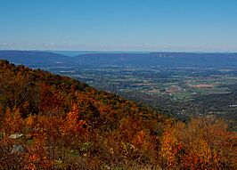
Distant view from the Fisher's Gap overlook on Skyline Drive
|
||
|
||

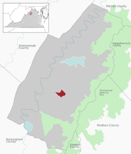
Location of Stanley within the Page county
|
||
| Country | United States | |
| State | Virginia | |
| County | Page | |
| Area | ||
| • Total | 1.44 sq mi (3.72 km2) | |
| • Land | 1.43 sq mi (3.71 km2) | |
| • Water | 0.00 sq mi (0.01 km2) | |
| Elevation | 1,093 ft (333 m) | |
| Population
(2020)
|
||
| • Total | 2,144 | |
| • Estimate
(2019)
|
1,673 | |
| • Density | 1,167.48/sq mi (450.66/km2) | |
| Time zone | UTC−5 (Eastern (EST)) | |
| • Summer (DST) | UTC−4 (EDT) | |
| ZIP code |
22851
|
|
| Area code(s) | 540 | |
| FIPS code | 51-75024 | |
| GNIS feature ID | 1487517 | |
Stanley is a town located in Page County, Virginia, in the United States. In 2023, about 1,723 people lived there. It's a small community in the beautiful Shenandoah Valley.
Contents
History of Stanley
Stanley has some important historical places. Two of these, Fort Philip Long and Graves Chapel and Cemetery, are listed on the National Register of Historic Places. This means they are recognized as special places that are worth protecting because of their history.
Geography and Location
Stanley is found at a specific spot on the map: 38.577649 degrees North and -78.508980 degrees West. This is its exact geographic location.
The town covers a total area of about 1.1 square miles (2.8 square kilometers). All of this area is land, meaning there are no large lakes or rivers within the town limits.
Transportation in Stanley
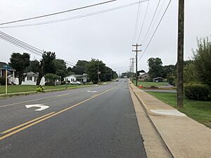
The main road that goes directly through Stanley is called U.S. Route 340 Business. This road helps people travel northeast and southwest out of town.
If you go northeast on US 340 Business, you will reach Luray. From there, it connects to U.S. Route 340 and continues towards Front Royal. If you travel southwest, US 340 Business also connects to US 340. This route will take you to towns like Shenandoah, Elkton, and Waynesboro.
Population and People
| Historical population | |||
|---|---|---|---|
| Census | Pop. | %± | |
| 1910 | 218 | — | |
| 1920 | 449 | 106.0% | |
| 1930 | 259 | −42.3% | |
| 1940 | 317 | 22.4% | |
| 1950 | 399 | 25.9% | |
| 1960 | 1,039 | 160.4% | |
| 1970 | 1,208 | 16.3% | |
| 1980 | 1,204 | −0.3% | |
| 1990 | 1,186 | −1.5% | |
| 2000 | 1,326 | 11.8% | |
| 2010 | 1,689 | 27.4% | |
| 2019 (est.) | 1,673 | −0.9% | |
| U.S. Decennial Census | |||
In 2023, there were about 1,723 people living in Stanley. These people made up 562 households. A household is a group of people living together in one home.
Most of the people in Stanley are White. About 97.89% of the population is White. A small number of people are from other backgrounds. About 2.49% of the population is Hispanic or Latino.
The town has a mix of different age groups. About 23.9% of the people are under 18 years old. About 15.9% are 65 years old or older. The average age in Stanley is 37 years.
Education in Stanley
Students in Stanley attend schools that are part of the Page County Public Schools system.
Public Schools in Stanley
- Stanley Elementary School serves younger students from Pre-Kindergarten up to 5th grade.
- Older students attend Page County Middle School and Page County High School. These schools serve students from the southern part of Page County, including Stanley.
Technical Training
The Page County Technical Center is also part of the Page County Public Schools system. This center offers various programs for both high school students and adults. It helps them learn skills for different jobs and careers.
See also
 In Spanish: Stanley (Virginia) para niños
 | Misty Copeland |
 | Raven Wilkinson |
 | Debra Austin |
 | Aesha Ash |


