Star Range facts for kids
Quick facts for kids Star Range |
|
|---|---|
| Highest point | |
| Peak | Topache Peak |
| Elevation | 6,880 ft (2,100 m) |
| Dimensions | |
| Length | 8 mi (13 km) SW x NE |
| Geography | |
| Country | United States |
| State | Utah |
| County | Beaver |
| Settlement | Milford |
| Borders on | San Francisco Mountains-NW Beaver Lake Mountains-N Milford & Milford Valley-E (Mineral Mountains-E) Escalante Desert-SE, S & SW |
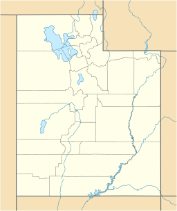
The Star Range is a small mountain range in central Beaver County, Utah. It is about 8 miles (12 km) long. The range gets its name because its small ridges spread out from peaks, looking like the fingers of a hand or the points of a star.
Right next to the Star Range, to the southwest, are the Shauntie Hills. These hills also have ridges that look like more "fingers" of the star shape. Both the Star Range and the Shauntie Hills gently slope north. They lead towards flat areas south of the Sevier Lake region. These flatlands are also near the San Francisco Mountains.
The southern part of the Star Range is next to the Escalante Desert. To the east, you'll find the Milford Valley. This valley is home to the town of Milford. The Beaver River (Sevier River) flows north through this valley. The Mineral Mountains are also nearby, bordering the valley to the east.
About the Star Range
The Star Range stretches for about 8 miles (12 km). It runs from the southwest to the northeast.
The highest point in the range is called Topache Peak. This peak is located in the center-southeast part of the range. It stands tall at 6,880 feet (2,097 meters) high. Topache Peak is right on the edge of the Escalante Desert.
How to Visit the Star Range
You can get to the northeast or south side of the Star Range using Utah State Route 21. This road starts from the town of Milford.
Utah State Route 21 turns west when it leaves Milford. It then crosses the northern foothills of the Star Range. You can also reach the northwest side of the range from this same road. Further west, there's a place called The Big Wash. This wash collects water from the northwest foothills. Utah State Route 21 continues on to the southeast side of the San Francisco Mountains. This is about 13 miles (21 km) from Milford.
 | Calvin Brent |
 | Walter T. Bailey |
 | Martha Cassell Thompson |
 | Alberta Jeannette Cassell |


