Beaver Lake Mountains facts for kids
Quick facts for kids Beaver Lake Mountains |
|
|---|---|

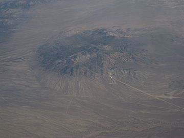
Aerial view of the Beaver Lake Mountains from the south, August 2009
|
|
| Highest point | |
| Peak | (Beaver Lake Mountains (north terminus peak)) |
| Elevation | 6,895 ft (2,102 m) |
| Dimensions | |
| Length | 8 mi (13 km) |
| Geography | |
| Country | United States |
| Communities | Milford and Frisco |
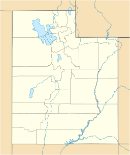
| Range coordinates | 38°30′58″N 113°07′02″W / 38.51611°N 113.11722°W |
The Beaver Lake Mountains is a mountain range in Utah, United States. It is about 8 miles (13 km) long. You can find it in central and northern Beaver County. It is also very close to the southern edge of Millard County.
The Beaver River runs along the eastern side of these mountains. This river flows north past the town of Milford. It comes from the Beaver Valley and the southern part of the Mineral Mountains. The river eventually flows towards the Sevier River. However, farms use a lot of its water, so it doesn't always flow all the way through the Sevier Desert.
What are the Beaver Lake Mountains like?
The Beaver Lake Mountains are made up of three main parts. The southwest part has a large, rounded mountain area called a massif. This part is about 6,794 feet (2,071 meters) high. It is also about 3 miles (5 km) wide.
Next to this massif, on the northeast side, is Lime Mountain. There are also smaller hills called Badger Knolls to the east. These hills are about 5,450 feet (1,661 meters) high.
The Rocky Range is a separate mountain range to the southeast. It is about 2.5 miles (4 km) long. This range is surrounded by dry streambeds, called washes. These washes connect to the Beaver River in the east.
How to get to the Beaver Lake Mountains
You can reach the Beaver Lake Mountains from Milford. Milford is about 9 miles (14 km) to the southeast. Utah State Route 21 runs southwest of the mountains. This road goes through an area called The Big Wash. It also passes the foothills of the nearby Star Range.
There are also dirt roads that go north from The Big Wash. These roads cross over to the foothills of the Beaver Lake Mountains. Some roads go right into the mountains. One road even goes all the way around the foothills of Lime Mountain and the Beaver Lake Mountains. This route is about 22 miles (35 km) long. The Rocky Range, which is southeast of the Beaver Lake Mountains, also has many dirt roads for access.
You can also get to the northeast and east parts of the mountains from Utah 257. This is a road that runs north and south. To reach the Rocky Range section from the southwest, you need to go around the Beaver River. This means you would access it from the northern parts of Milford.
The Beaver Lake Mountains are also easy to reach from the San Francisco Mountains. The foothills between these two mountain ranges are only about 2 miles (3 km) apart.
 | Selma Burke |
 | Pauline Powell Burns |
 | Frederick J. Brown |
 | Robert Blackburn |


