Star Valley, Arizona facts for kids
Quick facts for kids
Star Valley, Arizona
|
||
|---|---|---|
|
||

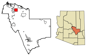
Location of Star Valley in Gila County, Arizona
|
||
| Country | United States | |
| State | Arizona | |
| Counties | Gila | |
| Incorporated | 2005 | |
| Government | ||
| • Type | Council-manager | |
| Area | ||
| • Total | 36.15 sq mi (93.64 km2) | |
| • Land | 36.14 sq mi (93.61 km2) | |
| • Water | 0.01 sq mi (0.02 km2) | |
| Elevation | 4,650 ft (1,420 m) | |
| Population
(2020)
|
||
| • Total | 2,484 | |
| • Density | 68.73/sq mi (26.54/km2) | |
| Time zone | UTC-7 (MST (no DST)) | |
| ZIP code |
85541
|
|
| Area code(s) | 928 | |
| FIPS code | 04-69480 | |
Star Valley is a town in Gila County, Arizona, United States. It became an official town in 2005. Before that, it was a "census-designated place" (CDP), which means it was a community recognized for counting people, but not an official town. According to the 2020 census, about 2,484 people live there.
Contents
Exploring Star Valley's Location
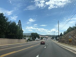
Star Valley is located in the northern part of Gila County, Arizona. It shares a border with the town of Payson to its west. Arizona State Route 260 is a main road that goes through Star Valley. This highway leads about 4 miles west to Payson and about 85 miles east to Show Low.
Land and Water Features
The town covers a total area of about 93.6 square kilometers (36.15 square miles). Only a very small part of this area, about 0.02 square kilometers (0.01 square miles), is water. Star Valley sits at an elevation of about 4,650 feet (1,417 meters) above sea level.
The town gets its name from the valley where it is located. This valley was formed by Houston Creek, a stream that flows south through the Tonto National Forest. Houston Creek eventually joins Tonto Creek, which is a branch of the Salt River. When the town first became official, it was called Diamond Star, but its name was changed to Star Valley in 2006.
People of Star Valley
| Historical population | |||
|---|---|---|---|
| Census | Pop. | %± | |
| 2000 | 1,536 | — | |
| 2010 | 2,310 | 50.4% | |
| 2020 | 2,484 | 7.5% | |
| U.S. Decennial Census | |||
In 2000, there were 1,536 people living in Star Valley. By 2020, the population had grown to 2,484 people.
Community Life
In 2000, there were 677 households in the area. A household is a group of people living together in one home. About 24.4% of these households had children under 18 years old living with them. Many households were married couples, and some were individuals living alone.
The average age of people in Star Valley in 2000 was 44 years old. About 22.9% of the population was under 18, and 21.2% was 65 years or older. This shows a mix of different age groups living in the community.
Getting Around Star Valley
The Payson Senior Center helps people get around by operating a bus service called the Beeline Bus. This bus provides local transportation between Payson and Star Valley, making it easier for residents to travel.
Learning in Star Valley
Students in Star Valley attend schools that are part of the Payson Unified School District. The main high school for students in this area is Payson High School.
See also
 In Spanish: Star Valley (Arizona) para niños


