
State Street (Chicago) facts for kids
State Street is a very important road in Chicago, a big city in the USA. It's special because it's considered the 'starting line' for measuring how far east or west things are in Chicago. Imagine a giant map of Chicago; State Street is the main line that divides the city into east and west sections. People think this street was once the edge of Lake Michigan before the Great Chicago Fire changed the city. Unlike other big roads that run north and south, State Street is called a "street" instead of an "avenue" to help everyone remember its special role as the zero point for east and west measurements.
The Chicago Transit Authority's (CTA) Red Line train, which is part of Chicago's subway system, runs right underneath State Street for a long distance. This makes it easy for people to travel along this famous road.
Chicago's Center Point
Just like State Street is the zero point for east and west, Madison Street is the zero point for north and south in Chicago. Where State Street and Madison Street meet is like the very center of Chicago's address system! Many famous buildings have been on Madison Street, including the old Chicago Stadium and the current United Center. Both of these places are big sports arenas and have been nicknamed the "Madhouse on Madison" because of how exciting and loud they get during games.
Images for kids
-
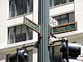
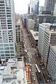
The crossroads of Chicago's address system at State and Madison Streets
-
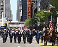
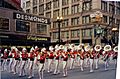
Chief of Staff of the United States Army Gen. George W. Casey Jr., Chicago Mayor Richard M. Daley, and other officials during May 24, 2008 Memorial Day parade on State Street
-
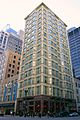
Reliance Building (1890), 32 N. State Street
-
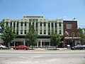
Chicago Bee Building, 3647-55 S. State
-
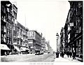
State Street in 1893
-
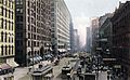
State Street circa the late 19th century
-
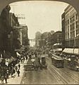
State Street in 1907
-
State Street in 1949 as photographed by Stanley Kubrick for Look Magazine
-
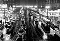
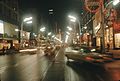
State Street in 1952
-
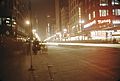
State Street in 1953
-
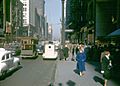
State Street in 1969
-
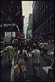
State Street in October 1973 as photographed by Documerica
-
parade in 2000
-
State Street looking north in 2007
-
State Street in 2012
-
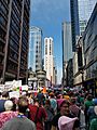
State Street in 2017 during the Tax Day March


.JPG)

.jpg)


.jpg)
_00208_Chicago_nite_state_street_1953_(37458820170).jpg)
_00386Chicago_Loop_Christmas_time_-_developed_March_1970_(37006611384).jpg)

.jpg)


See also
 In Spanish: State Street (Chicago) para niños
