
Stockholm, New York facts for kids
Quick facts for kids
Stockholm, New York
|
|
|---|---|

Signage denoting entrance into the town of Stockholm along New York State Route 11B.
|
|

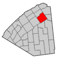
Map highlighting Stockholm's location within St. Lawrence County.
|
|

Stockholm, New York
Location in New York Adirondack Park
|
|
| Country | United States |
| State | New York |
| County | St. Lawrence |
| Area | |
| • Total | 94.29 sq mi (244.21 km2) |
| • Land | 93.90 sq mi (243.19 km2) |
| • Water | 0.39 sq mi (1.02 km2) |
| Elevation | 381 ft (116 m) |
| Population
(2020)
|
|
| • Total | 3,816 |
| • Density | 38.57/sq mi (14.89/km2) |
| Time zone | UTC-5 (Eastern (EST)) |
| • Summer (DST) | UTC-4 (EDT) |
| FIPS code | 36-71410 |
| GNIS feature ID | 0979528 |
Stockholm is a small town located in St. Lawrence County, New York, in the United States. In 2020, about 3,816 people lived there. The town got its name from Stockholm, a city in Sweden, thanks to the surveyors who mapped the area.
Stockholm is in the northeastern part of St. Lawrence County. It is also northeast of the village of Potsdam.
Contents
History of Stockholm
The town of Stockholm was created on February 21, 1806. It was formed from a part of the town of Massena. As mentioned, its name came from the city of Stockholm in Sweden.
Stockholm kept its original size for many years. However, some parts of the town were later given to the nearby town of Norfolk. This happened on April 9, 1823, and again on April 15, 1834. During the War of 1812, some people left Stockholm, and not everyone returned after the war ended.
Geography of Stockholm
Stockholm covers a total area of about 94.3 square miles (244.2 square kilometers). Most of this area is land, about 93.9 square miles (243.2 square kilometers). A small part, about 0.3 square miles (1.02 square kilometers), is water.
The St. Regis River flows north through the eastern side of the town. This river is an important natural feature of the area.
Major roads also pass through Stockholm. U.S. Route 11 goes right through the town. Additionally, New York State Route 420 crosses the northeastern corner of Stockholm.
Population Changes
The population of Stockholm has changed over the years. Here is a look at how many people have lived in the town during different census years:
| Historical population | |||
|---|---|---|---|
| Census | Pop. | %± | |
| 1820 | 822 | — | |
| 1830 | 1,944 | 136.5% | |
| 1840 | 2,995 | 54.1% | |
| 1850 | 3,661 | 22.2% | |
| 1860 | 4,074 | 11.3% | |
| 1870 | 3,819 | −6.3% | |
| 1880 | 3,441 | −9.9% | |
| 1890 | 2,999 | −12.8% | |
| 1900 | 2,826 | −5.8% | |
| 1910 | 2,614 | −7.5% | |
| 1920 | 2,437 | −6.8% | |
| 1930 | 2,253 | −7.6% | |
| 1940 | 2,406 | 6.8% | |
| 1950 | 2,558 | 6.3% | |
| 1960 | 3,465 | 35.5% | |
| 1970 | 3,597 | 3.8% | |
| 1980 | 3,676 | 2.2% | |
| 1990 | 3,533 | −3.9% | |
| 2000 | 3,592 | 1.7% | |
| 2010 | 3,665 | 2.0% | |
| 2020 | 3,816 | 4.1% | |
| U.S. Decennial Census | |||
In 2000, there were 3,592 people living in Stockholm. These people made up 1,381 households and 999 families. The town had about 38 people per square mile (14.89 per square kilometer).
About 35.8% of the households had children under 18 living with them. The average household had about 2.60 people. The average family had about 3.01 people.
The population was spread out by age. About 27.6% of the people were under 18 years old. The median age in the town was 36 years. This means half the people were younger than 36, and half were older.
Communities and Places in Stockholm
Stockholm is made up of several smaller communities and locations. Here are some of them:
- Armstrong Corners – A small community on US-11, near the western edge of the town.
- Beechertown – A community located close to the southern border of the town.
- Brookdale (also known as "Scotland") – You can find this community on County Road 49.
- Buckton (or "Bucks Corners") – This spot is south of Stockholm Center on County Road 47.
- Converse – A community in the southern part of the town, located on NY-11B.
- East Part – This community is east of Stockholm Center, along US-11.
- Kellogg – Found in the southeastern corner of the town on County Road 49.
- North Stockholm – A community located in the northwestern part of the town.
- Sandfordville – This community is in the western part of the town.
- Skinnerville – A community north of Stockholm Center, right by the St. Regis River.
- Southville – Located in the southern part of the town on NY-11B. It used to be called "South Stockholm."
- Stockholm Center – A central community in the town, located on US-11.
- West Stockholm – This community, once called "Bickneyville," is in the western part of the town. The West Stockholm Historic District is a special area here, recognized for its history in 1979.
- Winthrop (formerly "Stockholm" and "Stockholm Depot") – A community in the eastern part of the town on NY-11C, also by the St. Regis River.
Images for kids
-

Signage denoting entrance into the town of Stockholm along New York State Route 11B.
-
Map highlighting Stockholm's location within St. Lawrence County.
See also
 In Spanish: Stockholm (Nueva York) para niños
