Stollberg Rural District facts for kids
Quick facts for kids
Stollberg
|
||
|---|---|---|
|
||
 |
||
| Country | ||
| State | Saxony | |
| Capital | Stollberg | |
| Area | ||
| • Total | 266.49 km2 (102.89 sq mi) | |
| Population
(2001)
|
||
| • Total | 93,041 | |
| • Density | 349.135/km2 (904.256/sq mi) | |
| Time zone | UTC+1 (CET) | |
| • Summer (DST) | UTC+2 (CEST) | |
| Vehicle registration | STL | |
| Website | landkreis-stollberg.de | |
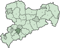
The Stollberg Rural District was a special area, like a county, located in the Free State of Saxony in Germany. It was next to the Chemnitzer Land area. This district no longer exists today, as it was dissolved in 2008.
Contents
A Look Back: History of Stollberg
The Stollberg district was first created a long time ago, in 1910. However, it was later dissolved in 1950, meaning it stopped being a district for a short time. Just two years later, in 1952, it was set up again!
In 1994, there was a big change in how districts were organized. During this time, the Stollberg Rural District became much larger. It gained some smaller towns and villages that used to belong to the city of Zwönitz and other districts like Chemnitz and Aue.
The Stollberg Rural District was located on the northwestern side of the Erzgebirge Mountains. These mountains are also known as the Ore Mountains.
Friends Across Germany
Since 1990, the Stollberg district had a special friendship, called a partnership, with another district. This partner district is named Fürth, and it is located in Bavaria, another part of Germany. These partnerships often involve cultural exchanges and working together on different projects.
What's on the Coat of Arms?
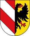
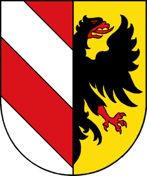
The coat of arms is like a special symbol or flag for the district. It tells a story about the area's past.
- The left side of the coat of arms shows a symbol that belonged to the Counts of Schönberg. These counts used to rule most of the land that became the Stollberg district.
- On the right side, you can see an imperial eagle. This eagle represents the Pleissenland, which was a special area that belonged directly to the emperor a long time ago.
- The colors on the right side are also the same as those used by Meißen. Another part of the Stollberg district historically belonged to the County of Meißen.
Towns and Villages in Stollberg
The Stollberg Rural District was made up of several towns and smaller communities called municipalities. Here are some of them:
Cities
- Lugau
- Oelsnitz
- Stollberg
- Thalheim
- Zwönitz
Municipalities
- Auerbach
- Burkhardtsdorf
- Erlbach-Kirchberg
- Gornsdorf
- Hohndorf
- Hormersdorf
- Jahnsdorf
- Neukirchen
- Niederdorf
- Niederwürschnitz
 | Percy Lavon Julian |
 | Katherine Johnson |
 | George Washington Carver |
 | Annie Easley |


