
Stonewall, Louisiana facts for kids
Quick facts for kids
Stonewall, Louisiana
|
|
|---|---|
| Town of Stonewall | |

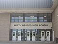
North DeSoto High School in Stonewall
|
|
| Motto(s):
"A great place to live"
|
|

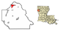
Location of Stonewall in De Soto Parish, Louisiana.
|
|
| Country | |
| States | |
| Parish | DeSoto |
| Founded | Early 1830s |
| Incorporated (village) | July 12, 1972 |
| Incorporated (town) | Spring of 1974 |
| Area | |
| • Total | 8.64 sq mi (22.37 km2) |
| • Land | 8.51 sq mi (22.05 km2) |
| • Water | 0.13 sq mi (0.32 km2) |
| Elevation | 213 ft (65 m) |
| Population
(2020)
|
|
| • Total | 2,273 |
| • Density | 266.97/sq mi (103.08/km2) |
| Time zone | UTC-6 (CST) |
| • Summer (DST) | UTC-5 (CDT) |
| ZIP code |
71078
|
| Area code | 318 |
Stonewall is a town located in northern DeSoto Parish, Louisiana, in the United States. Its population was about 1,800 people in 2010, growing to over 2,200 by 2020. Stonewall is part of the larger Shreveport-Bossier City area.
You can find North DeSoto High School and the Garland Scout Ranch of the Boy Scouts of America in Stonewall.
Contents
History of Stonewall
The first settlers arrived in the Stonewall area in the early 1830s. Colonel Edwards moved his family from South Carolina to a place they called the Bee Gum Community. This community was about three miles east of where Stonewall is today.
Later, friends of Colonel Edwards also moved to the North DeSoto area. These families included the Witherspoons, Marshalls, and Hollembeaks. They traveled by carriages and horses, bringing their belongings in wagons.
Early Community Life
As more families settled, they needed more supplies. These were ordered from New Orleans and shipped to Shreve's Port on the Red River. Getting to Shreve's Port was a long trip by wagon over rough roads. So, these trips were not made very often.
Many other families soon came to make their homes here. Families like the Williamsons, Powells, Andrews, and Loftus helped build the community.
Mail Service and New Name
The first Post Office for the Bee Gum Community was called Black Jack. It was used in the 1860s and was near Colonel Edwards' home, Welcome Hall. Mail delivery was not regular back then. Later, the Star Route Mail service began, running once or twice a week. This route connected Shreve's Port to Spring Ridge, Stonewall, Kingston, and Mansfield.
In 1862, the community moved its center about three miles west. This new location was along the new Texas & Pacific Railroad line. The community was then named Stonewall after the famous Civil War General, Stonewall Jackson.
Farming and Dairy Industry
In those days, cotton was a very important crop. Several large plantations, like Buena Vista and Welcome Hall, surrounded the Stonewall area.
A new business started in 1886 when Mrs. J.J. Marshall bought a special Jersey cow. This led to a successful dairy business that grew in the early 1900s. By 1943, there were 37 different dairies in Stonewall.
Modern Growth and Incorporation
Stonewall was mainly a farming and dairy community until the 1960s. People then started to notice how close it was to Shreveport. They also liked its friendly people and good schools. Soon, Stonewall began to grow as a "bedroom community" for people working in Shreveport.
Stonewall is located on Highway 171, a modern four-lane road. It is only six miles from Shreveport. Interstate 49 is also nearby, about a mile and a half east of town. Highway 171 was first graveled in 1916 and paved in the 1930s.
In 1971, a group of citizens asked the Governor to make Stonewall an official village. It became a village on July 12, 1972. Mr. Bob Midyett was appointed as the first Mayor. The first official election was held in the spring of 1974. Curtis L. McCune Jr. was elected Mayor.
Town Hall and Population Growth
Town meetings were first held at the First National Bank building. Later, they moved to the school cafeteria for more space. In December 1974, the town bought and remodeled the Cox & Hall building to be the Town Hall. This building was later sold and is now used as the DeSoto Parish Library.
The current Town Hall was bought in July 1983. It has been used for many things, including the Fire Department Office and voting polls. Part of it is now used by the DeSoto Parish Sheriff's Office as a Substation. This Substation opened on March 14, 1995.
Stonewall's population grew from 532 people in 1972 to over 1,000 by 1983. By 1995, it reached 1,500 people. The population was 1,814 in 2010 and 2,273 in 2020.
Geography of Stonewall

Stonewall is located in northern DeSoto Parish. You can find it at coordinates 32.267345 degrees North and 93.823589 degrees West. U.S. Route 171 goes through the town. This highway leads north 19 miles to Shreveport and south 22 miles to Mansfield. Mansfield is the main town of DeSoto Parish.
Stonewall-Frierson Road goes east from the town center for 4.5 miles to Exit 191 on Interstate 49. This interstate goes north to Shreveport and southeast 55 miles to the Natchitoches area.
The town of Stonewall covers a total area of about 8.64 square miles (22.37 square kilometers). Most of this area, about 8.51 square miles (22.05 square kilometers), is land. The rest, about 0.13 square miles (0.32 square kilometers), is water.
Population and Demographics
| Historical population | |||
|---|---|---|---|
| Census | Pop. | %± | |
| 1980 | 1,175 | — | |
| 1990 | 1,266 | 7.7% | |
| 2000 | 1,668 | 31.8% | |
| 2010 | 1,814 | 8.8% | |
| 2020 | 2,273 | 25.3% | |
| U.S. Decennial Census | |||
| Number | Percentage | |
|---|---|---|
| White (non-Hispanic) | 1,890 | 83.15% |
| Black or African American (non-Hispanic) | 146 | 6.42% |
| Native American | 31 | 1.36% |
| Asian | 16 | 0.7% |
| Other/Mixed | 118 | 5.19% |
| Hispanic or Latino | 72 | 3.17% |
As of the 2020 United States census, there were 2,273 people living in Stonewall. These people made up 1,127 households and 825 families.
National Register of Historic Places
The Buena Vista plantation is an important historical site in Stonewall. It was added to the National Register of Historic Places in 1989. This means it is recognized as a place worth preserving for its history.
Images for kids
-
North DeSoto High School in Stonewall
-
Location of Stonewall in De Soto Parish, Louisiana.
See also
 In Spanish: Stonewall (Luisiana) para niños
