Stuyvesant, New York facts for kids
Quick facts for kids
Stuyvesant, New York
|
|
|---|---|

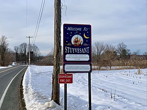
Welcome sign to the Town of Stuyvesant
|
|

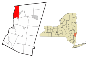
Location of Stuyvesant, New York
|
|
| Country | United States |
| State | New York |
| County | Columbia |
| Government | |
| • Type | Town Council |
| Area | |
| • Total | 26.75 sq mi (69.28 km2) |
| • Land | 25.00 sq mi (64.76 km2) |
| • Water | 1.75 sq mi (4.52 km2) |
| Elevation | 144 ft (44 m) |
| Population
(2020)
|
|
| • Total | 1,931 |
| • Density | 72.19/sq mi (27.872/km2) |
| Time zone | UTC-5 (Eastern (EST)) |
| • Summer (DST) | UTC-4 (EDT) |
| ZIP code |
12173
|
| Area code(s) | 518 |
| FIPS code | 36-021-71850 |
| GNIS feature ID | 0979534 |
Stuyvesant is a small town in Columbia County, New York, United States. It's located in the northwestern part of the county. In 2020, about 1,931 people lived there.
Contents
History of Stuyvesant
The area around Stuyvesant was first explored by Henry Hudson in 1609. People started settling here even before 1650 because it was right next to the Hudson River.
The town of Stuyvesant was officially created in 1823. It was formed from a part of the nearby town of Kinderhook.
Several historic buildings in Stuyvesant are listed on the National Register of Historic Places. These include the Requa House and the Stuyvesant Railroad Station.
Geography and Nature
Stuyvesant covers an area of about 69.3 square kilometers (26.75 square miles). Most of this area is land, with a small part being water.
The western edge of the town is the middle of the Hudson River. This river forms the border with Greene County. To the north, the town borders Rensselaer County.
A stream called Kinderhook Creek flows through the southeastern part of Stuyvesant.
Population and People
| Historical population | |||
|---|---|---|---|
| Census | Pop. | %± | |
| 1830 | 2,331 | — | |
| 1840 | 1,779 | −23.7% | |
| 1850 | 1,766 | −0.7% | |
| 1860 | 2,366 | 34.0% | |
| 1870 | 2,263 | −4.4% | |
| 1880 | 2,097 | −7.3% | |
| 1890 | 1,953 | −6.9% | |
| 1900 | 2,125 | 8.8% | |
| 1910 | 1,980 | −6.8% | |
| 1920 | 1,541 | −22.2% | |
| 1930 | 1,440 | −6.6% | |
| 1940 | 1,433 | −0.5% | |
| 1950 | 1,394 | −2.7% | |
| 1960 | 1,496 | 7.3% | |
| 1970 | 1,665 | 11.3% | |
| 1980 | 2,216 | 33.1% | |
| 1990 | 2,178 | −1.7% | |
| 2000 | 2,188 | 0.5% | |
| 2010 | 2,027 | −7.4% | |
| 2020 | 1,931 | −4.7% | |
| U.S. Decennial Census 2020 | |||
In 2020, the town of Stuyvesant had a population of 1,931 people. This was a bit less than the 2,027 people counted in 2010.
Communities and Places in Stuyvesant
Stuyvesant is made up of several smaller communities, often called hamlets.
- Poolsburg – This is a small community located on the north side of Stuyvesant.
- Newton Hook – You can find this hamlet in the southwestern part of the town, right by the Hudson River. It used to be called "Coxsackie Landing." This was because a ferry connected it to Coxsackie across the river.
- Stuyvesant – This is the main hamlet of the town, also known as "Stuyvesant Landing" or "Kinderhook Landing." It's close to the western town line and the Hudson River.
- Stuyvesant Falls – This hamlet is in the southeastern part of the town. It's named after a waterfall on Kinderhook Creek. It used to be called "Glencadia." This area has its own special ZIP code, 12174.
- Sunnyside – A hamlet located in the eastern part of the town, along Route 9.
See also

- In Spanish: Stuyvesant (Nueva York) para niños
 | Aaron Henry |
 | T. R. M. Howard |
 | Jesse Jackson |

