Sublette, Illinois facts for kids
Quick facts for kids
Sublette, Illinois
Hanno (1850-1854)
|
|
|---|---|

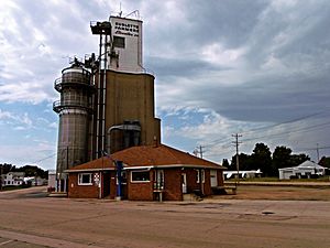
Sublette Farmers Co grain silo in downtown Sublette
|
|

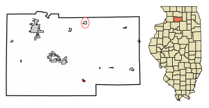
Location in Lee County, Illinois
|
|

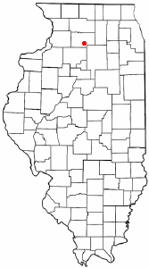
Location of Illinois in the United States
|
|
| Country | United States |
| State | Illinois |
| County | Lee |
| Township | Sublette |
| Incorporated | February 18, 1857 |
| Area | |
| • Total | 0.40 sq mi (1.04 km2) |
| • Land | 0.40 sq mi (1.04 km2) |
| • Water | 0.00 sq mi (0.00 km2) |
| Elevation | 927 ft (283 m) |
| Population
(2020)
|
|
| • Total | 380 |
| • Density | 947.63/sq mi (366.04/km2) |
| Time zone | UTC-6 (CST) |
| • Summer (DST) | UTC-5 (CDT) |
| ZIP code |
61367
|
| Area code(s) | 815 |
| FIPS code | 17-73287 |
| Wikimedia Commons | Sublette, Illinois |
Sublette is a small village located in Lee County, Illinois, United States. In 2020, about 380 people lived there.
History of Sublette
The first records of Sublette as a town are from maps made in the 1850s. Back then, it was called "Hanno." This name came from a city in Germany called Hanau, Prussia. It was a small group of houses north of another settlement called Knox Grove.
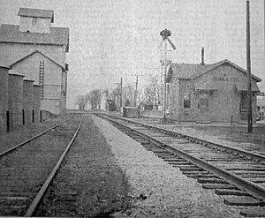
In 1854, the Illinois Central Railroad built a train line through Hanno. They also built a train station there for people and goods. A map from the next year showed the town's name as "Soublette." In 1857, the state government officially changed the town's name to "Sublette." The name is likely an American way of spelling the French last name Soblet. It has nothing to do with "subletting" (renting out something you're renting).
Geography of Sublette
Sublette is in the southern part of Lee County. Its exact location is 41°38′35″N 89°13′50″W / 41.64306°N 89.23056°W. U.S. Route 52 goes through the village. This road is also called North Pennsylvania Avenue.
US 52 goes northwest about 7 miles (11 km) to Amboy. It also goes southeast about 9 miles (14 km) to Mendota. Dixon is the main city of Lee County. It is about 20 miles (32 km) northwest of Sublette if you take US 52.
A private camping place called Woodhaven Lakes is about 3 miles (5 km) northwest of Sublette.
According to the 2010 census, Sublette covers about 0.35 square miles (0.91 square kilometers) of land. There is no water area within the village.
Population and People
| Historical population | |||
|---|---|---|---|
| Census | Pop. | %± | |
| 1900 | 306 | — | |
| 1910 | 287 | −6.2% | |
| 1920 | 262 | −8.7% | |
| 1930 | 261 | −0.4% | |
| 1940 | 282 | 8.0% | |
| 1950 | 290 | 2.8% | |
| 1960 | 306 | 5.5% | |
| 1970 | 361 | 18.0% | |
| 1980 | 442 | 22.4% | |
| 1990 | 394 | −10.9% | |
| 2000 | 456 | 15.7% | |
| 2010 | 449 | −1.5% | |
| 2020 | 380 | −15.4% | |
| U.S. Decennial Census | |||
In 2000, there were 456 people living in Sublette. These people lived in 189 households, and 127 of these were families. The village had about 1,303 people per square mile (503 per square kilometer).
About 30% of the households had children under 18 living with them. Many households (56.6%) were married couples living together. About 14% of households had someone living alone who was 65 years old or older.
The average age of people in the village was 38 years old. About 24% of the population was under 18. About 16% of the population was 65 years old or older.
See also
 In Spanish: Sublette (Illinois) para niños
 | Misty Copeland |
 | Raven Wilkinson |
 | Debra Austin |
 | Aesha Ash |


