Sugarite Canyon State Park facts for kids
Quick facts for kids Sugarite Canyon State Park |
|
|---|---|

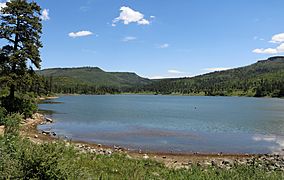
Lake Maloya, the park's main attraction
|
|
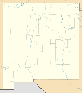
| Location | Colfax, New Mexico, United States |
| Area | 3,600 acres (15 km2) |
| Elevation | 6,950 ft (2,120 m) |
| Established | 1985 |
| Governing body | New Mexico State Parks Division |
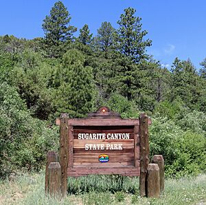
Sugarite Canyon State Park is a cool place in New Mexico, United States. It's a state park that shows off a historic coal-mining town from the early 1900s. You can also see amazing nature where the Rocky Mountains meet the Great Plains. This park is right on the border of Colorado and New Mexico. It's about 6 miles (9.7 km) northeast of a town called Raton, New Mexico.
Contents
What is Sugarite Canyon Like?
Sugarite Canyon (say it: “shug-ur-eet”) is found east of Raton Pass. This area has tall, flat-topped mountains called mesas. You'll also see cone-shaped volcanoes and old lava flows. Sugarite Canyon State Park is 3,600 acres (15 km2) big. It has a stream valley with basalt cliffs on its sides. Bartlett and Little Horse Mesas are to the west, and Horse Mesa is to the east. The park's elevation goes from 6,950 feet (2,120 m) at the entrance to 8,350 feet (2,550 m) on top of Little Horse Mesa. The park is about 4 miles (6.4 km) long and 1.5 miles (2.4 km) wide.
Plants and Animals in Sugarite Canyon
Most of the park is covered in thick forests. You'll find ponderosa pine and gambel oak trees. Near Chicorica Creek, at lower elevations, there are willow and cottonwood trees. Higher up, on slopes that face north, you can see Douglas fir, white fir, and aspen trees. The flat top of Little Horse Mesa is a big grassy field.
Many animals live in the park. These include mule deer, black bears, mountain lions, turkeys, and elk. The park has two man-made lakes: Lake Maloya (120 acres) and Lake Alice (3 acres). These lakes are stocked with rainbow and brown trout, so they are great for fishing. You can also enjoy seeing lots of butterflies and wildflowers. The views down Sugarite Valley to the Great Plains are truly beautiful.
What's the Weather Like in Sugarite Canyon?
July is the warmest month in Sugarite Canyon. The average high temperature is 78 °F (26 °C), and the average low is 47 °F (8 °C) at Lake Maloya. January is the coldest month. The average high is 41 °F (5 °C), and the low is 8 °F (−13 °C). The hottest temperature ever recorded was 93 °F (34 °C). The coldest ever was −33 °F (−36 °C).
The park gets about 24 inches (61 cm) of rain and snow each year. July and August are the wettest months. December and January are the driest. Most summer rain comes from afternoon thunderstorms. In winter, most of the precipitation is snow. It can snow a lot, especially at higher elevations. Sometimes, the park experiences dry periods in the summer.
The History of Sugarite Canyon
The name Sugarite might come from the Comanche and Ute word for a bird in the canyon. Or, it could come from the Spanish word "Chicorica" for a plant called chicory that grows here.
Sugarite Canyon started providing water to the town of Raton in 1891. The lakes in the park are still used for this purpose today. Coal mining began in the canyon in 1894. The town of Sugarite was built as a coal-mining town in 1912. At its busiest, nearly a thousand people lived in Sugarite. The mines started closing down in 1941. By 1944, the post office and railroad were shut down. Sugarite Canyon State Park was created in 1985. Now, about 125,000 people visit the park every year. The City of Raton owns the park's land and leases it to the State of New Mexico for 99 years.
Fun Things to Do at Sugarite Canyon
Visitor Center and Old Town Ruins
There's a visitor center near the park entrance. You can walk on a special trail that goes through the ruins of the old town and coal mine. This trail follows and crosses Sugarite Creek. There is a fee to enter the park.
Fishing and Boating
Lake Maloya and Lake Alice are great for trout fishing. You can use sailboats and boats with electric motors on Lake Maloya. There's a boat dock to help you launch your boat.
Camping and Picnicking
The park has places for camping. Eleven spots in Lake Alice Campground have electric hookups. There are 41 other camping spots for tents in Lake Alice and Soda Pocket Campground. You can also have picnics at both campgrounds. There are group shelters in the Gambel Oak Group Area for larger gatherings.
Hiking and Horseback Riding
There are 13 miles (21 km) of hiking trails in the park. Some trails start at the visitor center and lead to the old coal camp ruins. They also follow the stream in the valley. The longest trail is the Ponderosa Ridge/Opportunity Trail, which is 6 miles (9.7 km) long. It starts at Lake Maloya spillway, follows a small stream, climbs through a forest, and then goes back to where it started.
The Little Horse Mesa Trail is a 2-mile (3.2 km) round trip. It climbs steeply to the highest point in the park on Little Horse Mesa. The top of the mesa is flat and has very few trees. If you have horses, there are horse corrals near Soda Pocket Campground.
Winter Sports
You can go cross-country skiing all winter. Some roads and facilities might be closed, but skiing is still possible.
Rock Climbing
Rock climbing is allowed in the park. However, you are not allowed to add permanent bolts to the rocks.
Nearby Wildlife Areas
North of Sugarite Canyon State Park, in Colorado, are two State Wildlife Areas (SWA). These are Lake Dorothey (5,152 acres) and James M. John (8,339 acres). A public road goes north from Lake Maloya and ends at a small parking lot. You'll find a campsite, picnic area, and restrooms there. A .5-mile (0.80 km) trail leads to 10-acre (4.0 ha) Lake Dorothey. This lake is great for trout fishing and is in a meadow at 7,600 feet (2,300 m) elevation.
Beyond Lake Dorothey, an unmarked trail goes 4 miles (6.4 km) to the top of Fisher's Peak Mesa in James M. John SWA. The elevations in Lake Dorothey SWA range from 7,511 feet (2,289 m) to 9,079 feet (2,767 m). In James M. John SWA, they range from 7,468 feet (2,276 m) to 9,653 feet (2,942 m). You can only get to these areas by walking or riding a horse.
These wildlife areas allow hunting for animals like elk, deer, bear, mountain lion, turkey, and small game. James M. John SWA is closed from December 1 to April 1 each year. There's an annual butterfly festival where people count and identify butterflies in the meadows near Lake Dorothey. In 2006, they counted 637 butterflies from 38 different types in just one day!
 | Tommie Smith |
 | Simone Manuel |
 | Shani Davis |
 | Simone Biles |
 | Alice Coachman |


