Sugarloaf Key facts for kids

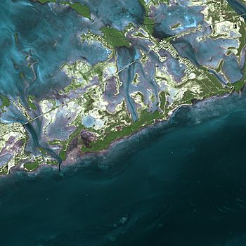
A satellite image of Sugarloaf Key
|
|
| Geography | |
|---|---|
| Location | Gulf of Mexico |
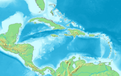
| Coordinates | 24°37′41″N 81°30′50″W / 24.628°N 81.514°W |
| Archipelago | Florida Keys |
| Adjacent bodies of water | Florida Straits |
| Administration | |
| State | Florida |
| County | Monroe |
Sugarloaf Key is an island in the lower Florida Keys. It looks like a single island but actually has two main communities. The island forms a loop on the Atlantic Ocean side, which can make it seem like there are separate islands. Even though it's called one island, Sugarloaf Key is home to two different areas: Lower Sugarloaf Key and Upper Sugarloaf Key.
Contents
History of Sugarloaf Key
The name 'Sugarloaf' might come from two things. One idea is that an old loaf of sugar-shaped mound was on the east side of Upper Sugarloaf Key. Another idea is that a type of pineapple called "sugarloaf" used to grow there. These pineapples were very soft and did not travel well. So, they are not often grown for sale anymore.
The community of Pirates Cove is also on the island. It was once a stop for the Overseas Railroad.
Geography of the Island
Sugarloaf Key has a somewhat U-shaped form. Upper Sugarloaf Sound and Park Key divide the island into Upper Sugarloaf Key and Lower Sugarloaf Key. These names simply describe their positions, not that they are separate islands.
Lower Sugarloaf Key
Lower Sugarloaf Key is about 13 miles (21 km) from Key West. It sits between Park Key and Saddlebunch Keys. This part of the island has more people living on it.
Upper Sugarloaf Key
Upper Sugarloaf Key is about 15 miles (24 km) east of Key West. It is located between Park Key and Cudjoe Key. Upper Sugarloaf Key is larger in size than Lower Sugarloaf Key.
Plants and Animals
Sugarloaf Key is home to many interesting plants and animals.
Island Plants
You can find several native plant species on the island. These include buttonwood trees and poisonwood trees. There are also sea grape plants and thatch palm trees.
Island Animals
Many animals live on or near Sugarloaf Key. Ibis birds can be seen on the island. In the waters nearby, you might spot dolphins and different kinds of fish. These include parrotfish, snapper, and barracuda. You might even see an octopus!
Community Life
Both Lower and Upper Sugarloaf Key have places for people to live, work, and visit.
Lower Sugarloaf Key Community
Lower Sugarloaf Key has a family-owned lodge and restaurant called Sugarloaf Lodge. It also has a small airport and the Sugarloaf Volunteer Fire Station. A unique building here is the Sugarloaf Key Bat Tower.
Upper Sugarloaf Key Community
Upper Sugarloaf Key has two public schools for children. There is also a church and other restaurants. You can find commercial offices and a public campground here. Part of the Great White Heron National Wildlife Refuge is also on Upper Sugarloaf Key.
Camping on Sugarloaf Key
Sugarloaf Key is home to the southernmost KOA campground in North America. This campground covers about 14 acres (5.7 hectares).
Getting Around
Transportation on Sugarloaf Key is mainly by road.
Main Roads
U.S. 1, also known as the Overseas Highway, crosses both parts of Sugarloaf Key. It runs through Upper Sugarloaf Key from mile markers 19 to 20.5. It also crosses Lower Sugarloaf Key from mile markers 16.5 to 17.5.
Future Bike Path
Sugarloaf Key is already part of the Overseas Highway. Soon, it will also be part of the Florida Keys Overseas Heritage Trail. This trail will connect mainland Florida to Key West with bicycle paths.
 | John T. Biggers |
 | Thomas Blackshear |
 | Mark Bradford |
 | Beverly Buchanan |


