Saddlebunch Keys facts for kids

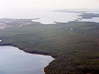
Aerial view of Saddlebunch Keys from the northeast, October 1987
|
|
| Geography | |
|---|---|
| Location | Gulf of Mexico |
| Coordinates | 24°37′57″N 81°36′21″W / 24.632584°N 81.60593°W |
| Archipelago | Florida Keys |
| Adjacent bodies of water | Florida Straits |
| Administration | |
| State | Florida |
| County | Monroe |
The Saddlebunch Keys are a group of small islands in Florida. They are mostly covered in mangrove trees. These islands are located about 7 miles (11 kilometers) east of Key West. They are part of the beautiful Florida Keys archipelago.
Contents
Exploring the Saddlebunch Keys
The Saddlebunch Keys are a fascinating part of the Florida Keys. They are known for their natural beauty and quiet communities. These islands are a great example of the unique environment found in southern Florida.
Where are the Saddlebunch Keys?
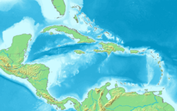
The Saddlebunch Keys are found in the Gulf of Mexico. They are located near the southern tip of Florida. These islands are scattered between Lower Sugarloaf Key and Shark Key. They are also part of the larger Florida Keys chain of islands. The waters around them are part of the Florida Straits.
Driving Through the Keys
A famous road called U.S. 1, also known as the Overseas Highway, crosses some of the Saddlebunch Keys. This highway is a long road that connects many of the Florida Keys. You can find the Saddlebunch Keys between mile markers 11.5 and 15 on this highway. Driving along this road offers amazing views of the ocean and islands.
Communities Near the Keys
Even though the Saddlebunch Keys are mostly natural, there are small communities nearby.
Bay Point Community
Just east of Big Coppitt Key and Shark Key is a small community called Bay Point. It has fewer than 500 residents. Bay Point has a county park where people can enjoy the outdoors. There are also two stores in the community.
Bluewater Key Community
West of Bay Point is another small community called Bluewater Key. This area has fewer than 100 residents. Both Bay Point and Bluewater Key are connected by a bike path. This path continues all the way to Big Coppitt Key, making it easy to cycle between these areas.
 | Bessie Coleman |
 | Spann Watson |
 | Jill E. Brown |
 | Sherman W. White |


