Sullivan, Wisconsin facts for kids
Quick facts for kids
Sullivan, Wisconsin
|
|
|---|---|

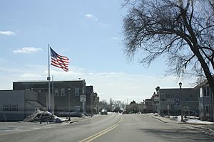
Looking west at downtown Sullivan
|
|

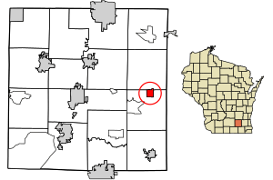
Location of Sullivan in Jefferson County, Wisconsin
|
|
| Country | |
| State | |
| County | Jefferson |
| Government | |
| • Type | Village Board |
| Area | |
| • Total | 1.14 sq mi (2.94 km2) |
| • Land | 1.13 sq mi (2.93 km2) |
| • Water | 0.00 sq mi (0.01 km2) |
| Elevation | 863 ft (263 m) |
| Population
(2020)
|
|
| • Total | 651 |
| • Density | 586.94/sq mi (226.63/km2) |
| Time zone | UTC-6 (Central (CST)) |
| • Summer (DST) | UTC-5 (CDT) |
| ZIP Code |
53178
|
| Area code(s) | 262 |
| FIPS code | 55-78200 |
| GNIS feature ID | 1575043 |
| Website | http://www.villageofsullivan-gov.us/ |
Sullivan, once called Winfield, is a small village in Jefferson County, Wisconsin. In 2020, about 651 people lived there. It is part of the larger Town of Sullivan.
Many people in southern Wisconsin know Sullivan because it is home to the National Weather Service forecast office MKX. This office helps predict the weather for areas like Madison and Milwaukee. Even though the office is in Sullivan, its mailing address is in nearby Dousman.
Contents
History of Sullivan
The village of Sullivan has a long history. A post office was first opened here in 1846. The village was named after the larger area, the Town of Sullivan.
Geography and Location
Sullivan is located at 43°0′46″N 88°35′15″W / 43.01278°N 88.58750°W. It is about 30 miles (48 km) west of Milwaukee. It is also about 40 miles (64 km) east of Madison. The village is located about 6 miles (10 km) south of Interstate 94.
The main part of Sullivan is where Main Street meets Palmyra Street. Main Street is also known as Highway 18 and Highway F. Palmyra Street is Highway E.
Size of the Village
According to the United States Census Bureau, Sullivan covers a total area of about 1.14 square miles (2.95 square kilometers). All of this area is land.
Sullivan's Climate
Sullivan experiences a climate with warm summers and cold winters. Here is a look at the typical weather:
| Climate data for Sullivan 3SE, Wisconsin (MKX Weather Forecast Office) (1991–2020 normals, extremes 1995–present) | |||||||||||||
|---|---|---|---|---|---|---|---|---|---|---|---|---|---|
| Month | Jan | Feb | Mar | Apr | May | Jun | Jul | Aug | Sep | Oct | Nov | Dec | Year |
| Record high °F (°C) | 60 (16) |
71 (22) |
85 (29) |
89 (32) |
95 (35) |
99 (37) |
106 (41) |
98 (37) |
96 (36) |
90 (32) |
75 (24) |
67 (19) |
106 (41) |
| Mean maximum °F (°C) | 49.4 (9.7) |
52.7 (11.5) |
68.3 (20.2) |
80.3 (26.8) |
86.5 (30.3) |
91.6 (33.1) |
93.1 (33.9) |
91.5 (33.1) |
89.3 (31.8) |
81.3 (27.4) |
66.1 (18.9) |
52.2 (11.2) |
95.2 (35.1) |
| Mean daily maximum °F (°C) | 26.9 (−2.8) |
31.0 (−0.6) |
43.2 (6.2) |
56.4 (13.6) |
68.5 (20.3) |
78.3 (25.7) |
82.1 (27.8) |
80.3 (26.8) |
73.3 (22.9) |
60.0 (15.6) |
45.0 (7.2) |
32.5 (0.3) |
56.5 (13.6) |
| Daily mean °F (°C) | 19.1 (−7.2) |
22.6 (−5.2) |
33.5 (0.8) |
45.6 (7.6) |
57.3 (14.1) |
67.2 (19.6) |
71.1 (21.7) |
69.4 (20.8) |
62.0 (16.7) |
49.8 (9.9) |
36.5 (2.5) |
24.9 (−3.9) |
46.6 (8.1) |
| Mean daily minimum °F (°C) | 11.3 (−11.5) |
14.1 (−9.9) |
23.9 (−4.5) |
34.7 (1.5) |
46.0 (7.8) |
56.1 (13.4) |
60.1 (15.6) |
58.6 (14.8) |
50.8 (10.4) |
39.5 (4.2) |
27.9 (−2.3) |
17.4 (−8.1) |
36.7 (2.6) |
| Mean minimum °F (°C) | −10.4 (−23.6) |
−5.3 (−20.7) |
3.7 (−15.7) |
21.8 (−5.7) |
32.3 (0.2) |
42.9 (6.1) |
48.7 (9.3) |
48.5 (9.2) |
36.5 (2.5) |
25.2 (−3.8) |
11.5 (−11.4) |
−3.0 (−19.4) |
−14.7 (−25.9) |
| Record low °F (°C) | −30 (−34) |
−29 (−34) |
−13 (−25) |
13 (−11) |
22 (−6) |
33 (1) |
41 (5) |
40 (4) |
29 (−2) |
19 (−7) |
−2 (−19) |
−16 (−27) |
−30 (−34) |
| Average precipitation inches (mm) | 1.68 (43) |
1.78 (45) |
2.13 (54) |
3.85 (98) |
4.25 (108) |
4.90 (124) |
4.11 (104) |
3.97 (101) |
3.47 (88) |
2.95 (75) |
2.35 (60) |
2.08 (53) |
37.52 (953) |
| Average snowfall inches (cm) | 13.2 (34) |
11.7 (30) |
6.3 (16) |
2.4 (6.1) |
0.0 (0.0) |
0.0 (0.0) |
0.0 (0.0) |
0.0 (0.0) |
0.0 (0.0) |
0.4 (1.0) |
3.2 (8.1) |
13.5 (34) |
50.7 (129) |
| Average precipitation days (≥ 0.01 in) | 10.6 | 10.1 | 9.9 | 12.5 | 14.2 | 12.7 | 9.9 | 10.7 | 9.3 | 11.4 | 9.5 | 10.7 | 131.5 |
| Average snowy days (≥ 0.1 in) | 9.4 | 8.3 | 4.8 | 1.7 | 0.1 | 0.0 | 0.0 | 0.0 | 0.0 | 0.3 | 2.8 | 8.4 | 35.8 |
| Source: NOAA | |||||||||||||
People of Sullivan: Demographics
| Historical population | |||
|---|---|---|---|
| Census | Pop. | %± | |
| 1920 | 320 | — | |
| 1930 | 323 | 0.9% | |
| 1940 | 286 | −11.5% | |
| 1950 | 349 | 22.0% | |
| 1960 | 418 | 19.8% | |
| 1970 | 467 | 11.7% | |
| 1980 | 434 | −7.1% | |
| 1990 | 432 | −0.5% | |
| 2000 | 688 | 59.3% | |
| 2010 | 669 | −2.8% | |
| 2020 | 651 | −2.7% | |
| U.S. Decennial Census | |||
The population of Sullivan has changed over the years. In 1920, there were 320 people. The population grew to 688 in 2000, but then slightly decreased to 651 by 2020.
What the 2010 Census Showed
The census is a count of all people living in an area. The 2010 census showed that 669 people lived in Sullivan. These people lived in 304 households. A household is a group of people living together in one home.
Most people in Sullivan were White (98.1%). A small number were African American, Native American, or Asian. Some people were of mixed race. About 1.6% of the population identified as Hispanic or Latino.
About 29.9% of households had children under 18 living with them. Many households (43.4%) were married couples. Some households were led by a single parent. About 41.8% of households were not families, meaning people lived alone or with roommates.
The average age in the village was 38.6 years. About 22.7% of residents were under 18. About 11.8% were 65 years old or older. The village had slightly more females (51.4%) than males (48.6%).
Education in Sullivan
Sullivan Elementary School used to be the only school in the village. It is no longer open in its original building. However, a new Sullivan Elementary School was built nearby. This new school is part of the Jefferson School District. It is located just a few blocks from Main Street.
See also
 In Spanish: Sullivan (Wisconsin) para niños
 | Ernest Everett Just |
 | Mary Jackson |
 | Emmett Chappelle |
 | Marie Maynard Daly |


