Summit Lake (Josephine Creek) facts for kids
Quick facts for kids Summit Lake |
|
|---|---|
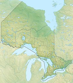
| Location | Unorganized North Part, Algoma District, Ontario |
| Coordinates | 48°06′29″N 84°37′45″W / 48.10806°N 84.62917°W |
| Primary outflows | Unnamed creek to Bog Lake |
| Basin countries | Canada |
| Max. length | 0.6 km (0.37 mi) |
| Max. width | 0.2 km (0.12 mi) |
| Surface elevation | 376 m (1,234 ft) |
Summit Lake is a small, quiet lake located in the Algoma District of Ontario, Canada. It's part of the larger Magpie River system, which eventually flows into Lake Superior. This lake is a great example of the many natural water bodies found in the northern parts of Ontario.
Contents
Discovering Summit Lake
Summit Lake is nestled in a part of Ontario known as the Unorganized North Part. This means it's in an area without a lot of towns or cities nearby. It's a place where nature really takes center stage.
Where is Summit Lake Located?
Summit Lake is found in the beautiful wilderness of the Algoma District. It's about 5 kilometres (3 mi) northwest of a small community called Hawk Junction. If you travel a bit further, about 16 kilometres (10 mi) northeast, you'll find the town of Wawa. These nearby spots give you an idea of its remote location.
How Big is Summit Lake?
Summit Lake is not a huge lake, but it's a peaceful one. It stretches about 0.6 kilometres (0.4 mi) long. Its width is around 0.2 kilometres (0.1 mi). The lake sits at an elevation of 376 metres (1,234 ft) above sea level. This means it's quite high up compared to the ocean.
Water Flow in Summit Lake
Lakes are often connected to other bodies of water, and Summit Lake is no different. It doesn't have any major rivers flowing into it. However, water does flow out of it! The main outflow is a small, unnamed creek. This creek leads to another body of water called Bog Lake. From there, the water continues its journey through Josephine Creek. Eventually, it joins the Magpie River, which then empties into the massive Lake Superior. This whole system is part of the Lake Superior drainage basin.
The Railway Connection
Even in this wild area, you can find signs of human activity. The Algoma Central Railway has a branch line that passes near Summit Lake. This railway line connects Hawk Junction to Michipicoten. It makes a loop south of the lake as it travels between Hawk Junction and Magpie. Railways like this were important for connecting remote areas and transporting goods.


