Sunflower, Arizona facts for kids
Quick facts for kids
Sunflower, Arizona
|
|
|---|---|

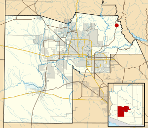
Location of Sunflower in Maricopa County, Arizona
|
|

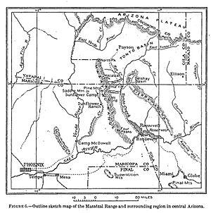
USGS map of Sunflower Mining District (1915)
|
|
| Country | United States |
| State | Arizona |
| County | Maricopa |
| Elevation | 3,405 ft (1,038 m) |
| Time zone | UTC-7 (Mountain (MST)) |
| Area code(s) | 480 |
| GNIS feature ID | 34951 |
Sunflower is a small, undeveloped area in Maricopa County, Arizona. It is located next to the Mazatzal Wilderness and west of Tonto National Forest. You can find it northwest of Roosevelt Reservoir.
Once, Sunflower was a busy place for mining a special metal called mercury. Today, it's a popular spot for people who love the outdoors. Hikers, campers, and those who enjoy off-road vehicle adventures often visit. Sunflower is close to Arizona State Route 87, which is also known as the Beeline Highway. It's about 22.8 miles (36.7 km) northeast of Fountain Hills.
Contents
A Look Back in Time
How Sunflower Got Its Name
The name "Sunflower" comes from an old ranch. Later, a mining camp, a mining company, and a mining district were also named Sunflower. This happened after E. H. Bowman found a metal called quicksilver (another name for mercury) in October 1911. He was looking for gold at the time.
The Importance of Mercury Mining
The mountains around Mazatzal, especially in Sunflower, were very important for mercury. Mines like Sunflower, Pine Mountain, and Rattlesnake produced most of Arizona's mercury. In fact, they were the source of 95 percent of all mercury found in the state.
Early Days and Development
Around 1915, visitors to the Tonto National Forest could find park rangers in Sunflower. For many years, it was just a simple campsite. But in the 1930s, Captain Harold Booth led groups from the Civilian Conservation Corps (CCC) to the area. The CCC was a program that helped young men find work during the Great Depression. They built things like roads and buildings in natural areas.
The Sunflower Ranch CCC camp was called site F-25-A. The Sunflower Ranger Station was built by the CCC in 1933. This historic building was later added to the National Register of Historic Places in 1993. This means it's recognized as an important historical site.
Community Life and Challenges
Before Sunflower had its own post office in 1945, the mail sometimes went to a place called Diamond Ranch. There was also a watering spot called Bushnell Tank nearby. The Forest Service and sheep farmers built it along the Heber–Reno Sheep Driveway. Water was piped in from a mountain spring, and it was a welcome stop for sheep after three days of travel.
In 1970, a big flood hit the area. This happened when the remains of Tropical Storm Norma passed through. The flood destroyed Sycamore Bridge, which connected Sunflower and Payson.
From Mining to Recreation
The mercury mine in Sunflower was closed down in the 1980s. Even though the mine was no longer active, the area remained popular. The "Sunflower Mine trail" was a bit rough, but it still attracted hikers.
Around 1987, Sunflower was planned as a rest stop for the Trans-Arizona Trail. However, the local store had burned down, so another supply spot was needed. Today, Sunflower is an important meeting point for sections 21 and 22 of the Arizona National Scenic Trail.
In 1997, the equipment used to get mercury from cinnabar (the ore) was still standing near Sycamore Creek. The Arizona Republic newspaper said that the trails in Sunflower showed how tough mining life was. They also showed how clever people had to be to build mining facilities in such difficult places. Before 1998, the road between Sunflower and Sycamore Creek was known for its steep, winding curves along the side of a mountain.
In 2005, people in the community had to leave their homes because of a fire nearby. In 2012, a large fire called the Sunflower Fire burned about 18,000 acres (73 km²). The fire started from a shotgun shell fired during a camping trip.
 | Stephanie Wilson |
 | Charles Bolden |
 | Ronald McNair |
 | Frederick D. Gregory |

