Theodore Roosevelt Lake facts for kids
Quick facts for kids Theodore Roosevelt Lake |
|
|---|---|
 |
|
| Location | Gila County, Arizona, United States |
| Coordinates | 33°40′18″N 111°09′40″W / 33.67167°N 111.16111°W |
| Type | reservoir |
| Primary inflows | Salt River, Tonto Creek |
| Catchment area | 5,830 mi² (15,099 km²) |
| Basin countries | United States |
| Max. length | 22.4 mi (35.8 km) |
| Max. width | 2 mi (3.2 km) |
| Surface area | 21,493 acres (8,698 ha) |
| Max. depth | 349 ft (106 m) |
| Water volume | 1,653,043 acre⋅ft (2.039 km3) (conservation) 2,910,200 acre⋅ft (3.590×10⁹ m3) (flood control) |
| Shore length1 | 128 mi (205 km) |
| Surface elevation | 2,094 ft (638 m) |
| 1 Shore length is not a well-defined measure. | |
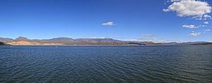
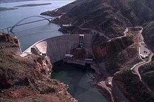
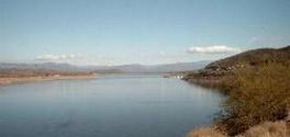
Theodore Roosevelt Lake, often called Roosevelt Lake, is a big reservoir in Arizona. It was created by the Theodore Roosevelt Dam on the Salt River. This lake is part of a big water system called the Salt River Project (SRP).
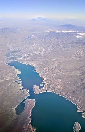
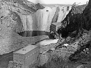
The lake is about 80 miles (130 km) northeast of Phoenix. It is the largest lake completely inside Arizona. Other large lakes like Lake Mead and Lake Powell are partly in other states. Both the lake and the dam are named after U.S. President Theodore Roosevelt. He officially opened the dam in March 1911.
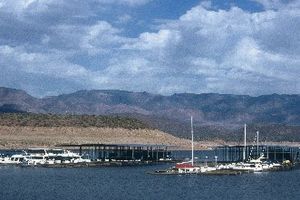
Roosevelt Lake is a popular place for fun activities. It is located within the Tonto National Forest. The forest manages all the visitor areas around the lake.
Roosevelt Lake is the oldest of six reservoirs built by the Salt River Project. It can hold the most water of all the SRP lakes. It can store about 1.65 million acre-feet of water for everyday use. When there is a lot of rain, the lake can hold even more water to prevent floods. However, extra water must be released within 20 days.
Where is Roosevelt Lake?
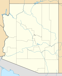
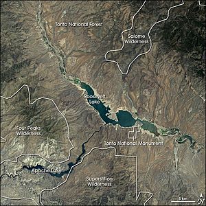
Roosevelt Lake is mostly in Gila County, Arizona. A small part of it is in Maricopa County. It is about 4 miles (6 km) upstream from Apache Lake. Apache Lake is the next SRP reservoir on the Salt River.
The lake covers about 10 miles (16 km) of the original Salt River path. It also stretches about 8 miles (13 km) up Tonto Creek. Tonto Creek is a major stream that flows into the Salt River. Its water comes from the Mogollon Rim.
The lake fills much of the Tonto Basin. This is a low area between the Sierra Ancha Mountains, Mazatzal Mountains, and the Superstition Mountains. State Route 188 runs along the lake's shore. Tonto National Monument is also close to the dam. From parts of the monument, you can see a lot of the lake.
Fun Activities and Wildlife
Fishing is a very popular activity at Roosevelt Lake. Many different kinds of fish live here. You can find crappie, carp, sunfish, and different types of catfish. There are also smallmouth bass and largemouth bass. For bass, there was a rule about their size. You could only keep one bass per day if it was between 13 and 16 inches long.
Roosevelt Lake used to be home to many southwestern willow flycatcher birds. These birds are federally endangered, meaning they are at risk of disappearing. After heavy rains in 2005, the lake's water level rose. Scientists are still studying how this affected the bird population.
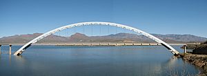
There are also several places to start hiking on the Arizona Trail near the lake. This long hiking trail is about 800 miles (1,280 km) long. It goes from the Arizona-Mexico border all the way to Utah. The trail crosses the Salt River on the bridge over Roosevelt Lake. This bridge is just northeast of the dam.
The lake also has a small airport called the Grapevine Airstrip. It is a small airport for private planes. It is located very close to the lake's shore. Many "fly-ins" happen here each year, where pilots fly in for events.
 | James Van Der Zee |
 | Alma Thomas |
 | Ellis Wilson |
 | Margaret Taylor-Burroughs |


