Mazatzal Mountains facts for kids
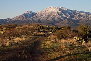
The Mazatzal Mountains (say it: Mah-zaht-ZAL) are a mountain range in central Arizona. They are about 30 to 45 miles northeast of Phoenix. People think the name might come from the Nahuatl language, meaning "place of the deer."
These mountains form the border between Maricopa County and Gila County. A major road, SR 87 (also called the Beeline Highway), goes through the Mazatzals on its way to Payson.
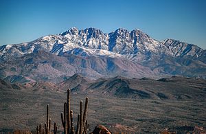
The tallest point is Mazatzal Peak, which is 7,903 feet (2,409 meters) high. Another famous part of the range is the Four Peaks. These peaks are 7,659 feet (2,334 meters) tall and are a well-known sight from the eastern Phoenix area.
Contents
Exploring the Mazatzal Wilderness Area
The Mazatzal Wilderness Area is a special protected space within the Mazatzal Mountains. It covers a huge area of 252,500 acres (1,022 square kilometers). This wilderness is part of both the Tonto and Coconino National Forests.
It was first set up in 1940 and made even bigger in 1984. The land here goes from 2,100 feet (640 meters) high at Sheep Bridge in the southwest to 7,903 feet (2,409 meters) at the top of Mazatzal Peak.
Landscapes of the Wilderness
The eastern part of the wilderness has mountains covered in bushes or pine trees. Sometimes, you'll see narrow canyons with very tall, straight walls.
On the western side, below the steep, brush-covered hills, the Verde River flows through the Sonoran Desert. The Verde River is very important. In 1984, the U.S. Congress named it one of Arizona's two Wild and Scenic Rivers. This means it's protected for its natural beauty and importance.
Geology of the Mazatzal Mountains
The Mazatzal Mountains show us some amazing things about Earth's history. Near Pine, at the northern end of the mountains, you can see where two very different types of rock meet.
The Great Unconformity
This meeting point is called the Great Unconformity. It's where flat layers of Tapeats Sandstone sit directly on top of much older Precambrian granite rock, called the Zoroaster Granite. The amazing part is that there's a gap of about 1 billion years between when the lower granite formed and when the sandstone was laid down!
This "missing time" in the rock record is also seen in other famous places, like the Grand Canyon. It shows how much erosion and change happened on Earth over incredibly long periods.
Connecting to the Mogollon Rim
South of Pine, Arizona State Route 87 is where the northern Mazatzal Mountains blend into the western edge of the Mogollon Rim. The Mogollon Rim is a huge cliff that stretches across Arizona. It continues northwest into the beautiful Oak Creek Canyon area.
 | Jewel Prestage |
 | Ella Baker |
 | Fannie Lou Hamer |


