
Pine, Arizona facts for kids
Quick facts for kids
Pine, Arizona
|
|
|---|---|

Trail up Pine Canyon, in the Tonto National Forest
|
|

Location in Gila County and the state of Arizona
|
|
| Country | United States |
| State | Arizona |
| County | Gila |
| Area | |
| • Total | 32.42 sq mi (83.97 km2) |
| • Land | 32.41 sq mi (83.95 km2) |
| • Water | 0.01 sq mi (0.02 km2) |
| Elevation | 5,369 ft (1,636 m) |
| Population
(2020)
|
|
| • Total | 1,953 |
| • Density | 60.25/sq mi (23.26/km2) |
| Time zone | UTC-7 (MST (no DST)) |
| ZIP code |
85544
|
| Area code(s) | 928 |
| FIPS code | 04-55700 |
| GNIS feature ID | 32916 |
Pine is a small community in Gila County, Arizona, United States. It is called a "census-designated place" (CDP) because it's a settled area that the government counts for population, but it's not officially a city or town with its own local government.
In 2020, about 1,953 people lived in Pine. The community was started in 1879 by four families who were Mormon.
Pine is located in north-central Arizona, near a large cliff called the Mogollon Rim. It's a popular spot for people to visit or live after they retire. Pine is about 5,369 feet (1,636 meters) above sea level. The first post office in Pine opened in 1884.
Where is Pine Located?

Pine is in the northwestern part of Gila County. It shares a border to the north with Coconino County, which runs along the edge of the Mogollon Rim. To the northwest, Pine is next to the community of Strawberry.
Arizona State Route 87 goes through Pine. This road leads northeast about 74 miles (119 km) to Winslow and southeast about 15 miles (24 km) to Payson.
The main part of Pine is in the valley of Pine Creek. This creek flows past a famous natural rock formation called Tonto Natural Bridge. It then continues to the East Verde River, which is about 10 miles (16 km) south of town. The total area of Pine is about 32.4 square miles (84.0 square kilometers). Only a tiny bit of this area is water.
Who Lives in Pine?
Pine has seen its population stay fairly steady over the years.
- In 2000, there were 1,931 people.
- In 2010, the population was 1,963.
- In 2020, it was 1,953 people.
In 2000, there were 882 homes in Pine. Most of the people living there were White (about 96.9%). A small number of people were from other racial backgrounds. About 1.8% of the population was Hispanic or Latino.
About 15.2% of the homes had children under 18 living there. Many homes (61.2%) were married couples. The average home had about 2.19 people, and the average family had about 2.57 people.
The people in Pine are of various ages. In 2000:
- 16.6% were under 18 years old.
- 41.0% were between 45 and 64 years old.
- 22.9% were 65 years or older.
The average age of people in Pine was 53 years.
The average income for a home in Pine was about $40,099. For families, the average income was about $45,947. About 9.3% of all the people in Pine lived below the poverty line. This included 21.3% of those under 18 and 4.1% of those 65 or older.
Images for kids
-
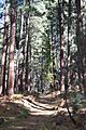
Trail up Pine Canyon, in the Tonto National Forest
-
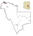
Location in Gila County and the state of Arizona
See also
 In Spanish: Pine (Arizona) para niños
