Superstition Mountain facts for kids
Quick facts for kids Superstition Mountain |
|
|---|---|

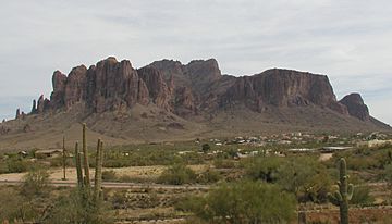
Superstition Mountain as seen from the west over Apache Junction in 2002
|
|
| Highest point | |
| Elevation | 5,059 ft (1,542 m) NAVD 88 |
| Prominence | 1,817 ft (554 m) |
| Naming | |
| Native name | Error {{native name}}: an IETF language tag as parameter {{{1}}} is required (help) |
| Geography | |
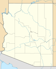
| Location | Pinal County, Arizona, U.S. |
| Parent range | Superstition Mountains |
| Topo map | USGS Goldfield |
Superstition Mountain is a famous landmark in Arizona, just east of the city of Phoenix. It's also known by its native names: Wi:kchsawa (Yavapai language) and Gakoḍk (O'odham language). This amazing mountain marks the western edge of the Superstition Wilderness Area, a special protected natural space.
Contents
How Superstition Mountain Was Formed
Superstition Mountain was created by powerful volcanic eruptions. These eruptions happened a very long time ago, between 20.5 and 18 million years ago.
Volcanic Activity
The mountain's western side is made of two main types of rock. One is called dacite lava, which is a type of hardened lava. The other is rhyolitic tuff, which is rock formed from volcanic ash.
During a huge eruption, a large area of land collapsed. This created a bowl-shaped dip in the ground called a caldera. Over time, the ground inside this caldera pushed upwards. This movement caused the softer tuff rock to wear away faster than the harder dacite lava. This is why the dacite cliffs are now exposed, giving the mountain its unique and famous shape.
Visiting Superstition Mountain
Superstition Mountain is a very popular place for outdoor activities. It is easy to reach from nearby towns like Apache Junction and Gold Canyon. You can get there using U.S. Route 60 or State Route 88.
Best Times to Visit
The mountain is a great place for hiking during fall, winter, and spring. These seasons have cooler temperatures, which are perfect for exploring. From June to September, it gets very hot, with temperatures often reaching 100 to 115°F (38 to 46°C). Most hikers prefer to visit during the cooler months.
Hiking Trails and Parks
On the western side of the mountain, you'll find Lost Dutchman State Park. This park has many hiking trails. Some trails lead to cool rock formations like the "Praying Hands" and "The Flatiron."
Another popular path is the Peralta Trail, located on the mountain's southern side. This trail goes over Fremont Saddle and then down into the wilderness area to the east. It's a great way to see more of the natural beauty around the mountain.
 | Precious Adams |
 | Lauren Anderson |
 | Janet Collins |


