Susan River (California) facts for kids
Quick facts for kids Susan River |
|
|---|---|
 |
|

|
|
| Country | United States |
| State | California |
| Region | Lassen County |
| Cities | Susanville, Johnstonville, Litchfield |
| Physical characteristics | |
| Main source | Caribou Lake 11 miles west of Norvell in the Lassen National Forest, Sierra Nevada, California 6,571 ft (2,003 m) 40°30′10″N 121°09′51″W / 40.50278°N 121.16417°W |
| River mouth | Honey Lake 3,993 ft (1,217 m) 40°20′11″N 120°15′27″W / 40.33639°N 120.25750°W |
| Length | 67 mi (108 km) |
| Basin features | |
| Basin size | 1,170 sq mi (3,000 km2) |
| Tributaries |
|
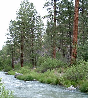
The Susan River is a river in northeastern California, United States. It flows for about 67 miles (108 kilometers). This river starts in high, dry lands made of volcanic rock. It then flows into Honey Lake, which sometimes dries up.
The Susan River flows through eastern Lassen County. It passes by the town of Susanville. The river is also known for marking the northern edge of the Sierra Nevada mountain range.
What is the History of the Susan River?
The Susan River and the town of Susanville got their names in 1857. They were named after Susan Roop. She was the daughter of an early settler named Isaac Roop.
Where Does the Susan River Flow?
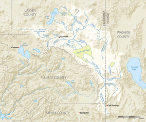
The Susan River begins at Caribou Lake. This lake is about 6,571 feet (2,003 meters) above sea level. A dam called Caribou Lake 234 Dam holds back the water there.
The river flows east and then turns southeast. It enters a large area called the Great Basin. Here, another stream called Bridge Creek joins it. The river is also dammed to create McCoy Flat Reservoir. This reservoir is about 11 miles (18 kilometers) northwest of Susanville.
As the river continues downstream, other small streams join it. These include Crazy Harry Gulch, Willard Creek, and Williams Creek. When the river reaches Susanville, Piute Creek flows into it from the left side.
Below Susanville, more streams add to the river. These are Gold Run Creek, Lassen Creek, and Sand Slough. Sand Slough joins the river near Johnstonville. At Johnstonville, some of the Susan River's water is sent south to Lake Leavitt through a canal.
After Willow Creek joins the Susan River, the river flows past Litchfield. In this area, many canals and levees change how the river flows. These are used to water the farms and ranches nearby. Finally, the Susan River reaches the Honey Lake State Wildlife Area. It then flows into Honey Lake, which is about 3,993 feet (1,217 meters) above sea level.
 | Ernest Everett Just |
 | Mary Jackson |
 | Emmett Chappelle |
 | Marie Maynard Daly |

