Symmes Creek facts for kids
Quick facts for kids Symmes Creek |
|
|---|---|

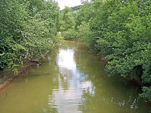
Symmes Creek near its mouth in Chesapeake in 2007
|
|
|
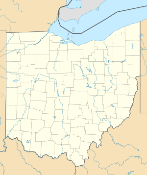
Location of the mouth of Symmes Creek in Chesapeake, Ohio
|
|
| Country | United States |
| State | Ohio |
| Physical characteristics | |
| Main source | Bloomfield Township, Jackson County 740 ft (230 m) 38°59′38″N 82°33′00″W / 38.99389°N 82.55000°W |
| River mouth | Ohio River Chesapeake 518 ft (158 m) 38°25′38″N 82°26′58″W / 38.42722°N 82.44944°W |
| Length | 76 mi (122 km) |
| Basin features | |
| Basin size | 357 sq mi (920 km2) |
Symmes Creek is a stream in southern Ohio, United States. It flows for about 76 miles (123 km). This creek is a tributary of the Ohio River. This means it flows into the Ohio River. Through the Ohio River, its water eventually reaches the Mississippi River. The creek helps drain an area of about 357 square miles (925 km²). This area is part of the Allegheny Plateau, a region not covered by glaciers long ago.
Symmes Creek starts in Bloomfield Township in southeastern Jackson County. It generally flows south. The creek passes through several townships. These include Madison Township in Jackson County. It also goes through Greenfield, Perry, and Walnut townships in Gallia County.
The creek then enters Lawrence County. Here it flows through Symmes, Aid, Mason, Lawrence, Windsor, and Union townships. It also flows through a part of the Ironton Unit of the Wayne National Forest.
Along its path, Symmes Creek passes by small communities. These include Waterloo, Aid, and Willow Wood. Finally, it joins the Ohio River at the village of Chesapeake. This spot is right across from downtown Huntington, West Virginia.
The official name "Symmes Creek" was decided in 1902. This was done by the United States Board on Geographic Names. Historically, the creek has also been called "Simms," "Big Creek," and "Symms Creek."
How Fast Symmes Creek Flows
The flow rate tells us how much water moves through the creek. At a special measuring station in Aid, Ohio, scientists check the water flow. This station is run by the United States Geological Survey.
Between November 2000 and September 2005, the average flow of Symmes Creek was 426 cubic feet per second (12 cubic meters per second). To help you imagine this, one cubic foot is about the size of a basketball. So, 426 basketballs of water passed by every second on average!
The fastest flow recorded during this time was on May 19, 2001. On that day, 7,100 cubic feet per second (201 cubic meters per second) of water rushed by. The slowest flow was on September 18, 2001, when only 1 cubic foot per second (0 cubic meters per second) was measured. This shows how much the creek's flow can change.
 | John T. Biggers |
 | Thomas Blackshear |
 | Mark Bradford |
 | Beverly Buchanan |


