
Syunik Province facts for kids
Quick facts for kids
Syunik
Սյունիք
|
|
|---|---|

Location of Syunik within Armenia
|
|
| Country | |
| Capital and largest city |
Kapan |
| Area | |
| • Total | 4,506 km2 (1,740 sq mi) |
| Area rank | 2nd |
| Highest elevation | 3,904 m (12,808 ft) |
| Lowest elevation | 380 m (1,250 ft) |
| Population
(2011)
|
|
| • Total | 141,771 |
| • Rank | 8th |
| • Density | 31.463/km2 (81.488/sq mi) |
| Time zone | AMT (UTC+04) |
| Postal code |
3201–3519
|
| ISO 3166 code | AM-SU |
| FIPS 10-4 | AM08 |
| HDI (2017) | 0.757 high · 3rd |
| Website | Official website: http://syunik.mtad.am/ |
Syunik is the southernmost province of Armenia. It's like a state or region within the country. Syunik shares borders with the Vayots Dzor Province to the north. To the west, it borders Azerbaijan's Nakhchivan region. To the east, it touches the Nagorno-Karabakh Republic, and to the south, it borders Iran.
The main city and capital of Syunik is Kapan. In 2011, about 141,771 people lived in Syunik. This number was a bit lower than in 2001.
Historically, Syunik was an important part of the ancient Kingdom of Armenia. It was one of its 15 provinces. Around the year 369, it became part of the Persian Empire.
Today, Syunik is known for its large mining operations. It has 7 urban areas (towns) and 102 rural areas (villages).
Images for kids
-
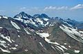
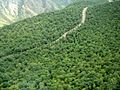
Arevik National Park in the mountains of Syunik
-
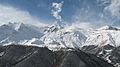
Mount Kaputjugh (3905 m.)
-
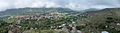
The town of Goris among the mountains of Zangezur
-
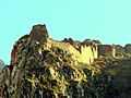
Baghaberd fortress from the 4th century
-
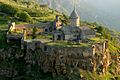
Tatev Monastery, built in the 8th century
-
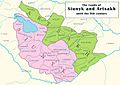
Syunik and Artsakh until the 9th century
-
Vorotnavank monastic complex from the 10th century
-
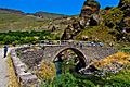
Melik Tangi Bridge, built in 1855 near Sisian
-
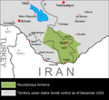
The Republic of Mountainous Armenia (1920-1921), mostly in modern-day Syunik
-
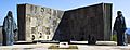
World War II memorial near Kapan, built in the 1970s
-
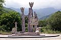
Garegin Nzhdeh's memorial near Kapan, opened in 2001
-
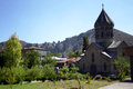
Cathedral of Saint Gregory in Goris, the seat of the Diocese of Syunik
-
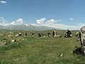
Zorats Karer
-
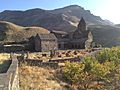
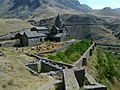
Vorotnavank monastery
-
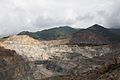
The open-pit copper-molybdenum mine of Kajaran
-
The view from the Wings of Tatev cableway
-
Shikahogh State Reserve
-
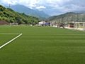
Gandzasar Kapan Training Centre
-
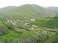
Dastakert
-
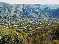
Goris
-
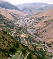
Kajaran
-
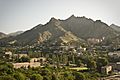
Meghri
-
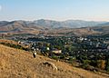
Sisian
-
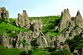
The "stone-pyramids" of Goris
-
Zangezur Sanctuary
-
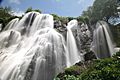
Shaki Waterfall
-
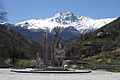
Monument to Garegin Nzhdeh and mount Khustup near Kapan
-
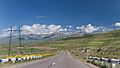
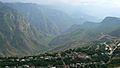
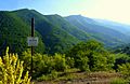
The landscape from the M-2 Motorway between Goris and Shaki


5.JPG)


.JPG)


.jpg)
See also
 In Spanish: Provincia de Syunik' para niños
