Taft, Oklahoma facts for kids
Quick facts for kids
Taft, Oklahoma
|
|
|---|---|

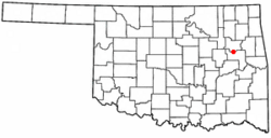
Location of Taft, Oklahoma
|
|
| Country | United States |
| State | Oklahoma |
| County | Muskogee |
| Area | |
| • Total | 1.56 sq mi (4.03 km2) |
| • Land | 1.55 sq mi (4.02 km2) |
| • Water | 0.01 sq mi (0.01 km2) |
| Elevation | 591 ft (180 m) |
| Population
(2020)
|
|
| • Total | 174 |
| • Density | 112.19/sq mi (43.32/km2) |
| Time zone | UTC-6 (Central (CST)) |
| • Summer (DST) | UTC-5 (CDT) |
| ZIP code |
74463
|
| Area code(s) | 539/918 |
| FIPS code | 40-72050 |
| GNIS feature ID | 2413361 |
Taft is a town located in Muskogee County, Oklahoma, in the United States. In 2020, the town had a population of 174 people. Taft started as a town for African Americans on land given to Creek Freedmen, who were formerly enslaved people of the Creek Nation. The town is named after William Howard Taft, who later became a U.S. President.
History of Taft
Taft began as a town for African Americans. It was built on land given to freed people from the Creek Nation. The town was first called Twine, named after William H. Twine. It even had its own post office by 1902.
Later, Mr. Twine moved away. The people of the town then voted to change the name to Taft. They chose this name to honor William Howard Taft. At that time, he was the Secretary of War for President Theodore Roosevelt.
Over the years, schools and training centers became important places to work in Taft. These included the W. T. Vernon School, opened in 1908. There was also the Industrial Institute for the Deaf, Blind, and Orphans of the Colored Race, which started in 1909. Other important schools were Moton High School and the State Training School for Negro Girls.
Taft is also home to two correctional facilities. These are the Dr. Eddie Warrior Correctional Center for women and the Jess Dunn Correctional Center for men.
In April 1973, Lelia Foley made history in Taft. She was elected as the Mayor of Taft. This made her one of the first African-American women to be elected mayor in the United States.
Geography of Taft
Taft is located about 8 miles (13 km) west of the city of Muskogee.
The United States Census Bureau reports that Taft covers a total area of 1.5 square miles (4.0 km²). All of this area is land.
People of Taft
| Historical population | |||
|---|---|---|---|
| Census | Pop. | %± | |
| 1910 | 352 | — | |
| 1920 | 553 | 57.1% | |
| 1930 | 690 | 24.8% | |
| 1940 | 772 | 11.9% | |
| 1950 | 541 | −29.9% | |
| 1960 | 386 | −28.7% | |
| 1970 | 525 | 36.0% | |
| 1980 | 489 | −6.9% | |
| 1990 | 400 | −18.2% | |
| 2000 | 349 | −12.7% | |
| 2010 | 250 | −28.4% | |
| 2020 | 174 | −30.4% | |
| U.S. Decennial Census | |||
In the year 2000, there were 349 people living in Taft. These people made up 136 households and 87 families. The town had about 228 people per square mile (88 per km²). There were 155 homes, with about 101 homes per square mile (39 per km²).
Most of the people in Taft were African American (85.39%). There were also White people (3.72%) and Native Americans (1.15%). Some people were from other backgrounds (0.29%) or from two or more races (9.46%). A small number (0.57%) were Hispanic or Latino.
About 33.1% of households had children under 18 living with them. About 36.0% were married couples. About 23.5% were single mothers. And 35.3% were not families. About 31.6% of all households were single people. About 12.5% had someone 65 or older living alone. The average household had 2.57 people. The average family had 3.30 people.
The population was spread out by age. About 35.0% were under 18. About 7.2% were 18 to 24. About 20.1% were 25 to 44. About 19.8% were 45 to 64. And 18.1% were 65 or older. The average age was 36 years. For every 100 females, there were about 75 males.
The average income for a household in Taft was $18,889. For a family, the average income was $26,500. Men earned about $20,417, while women earned about $17,813. The average income per person in the town was $11,278. About 23.0% of families and 33.7% of the total population lived below the poverty line. This included 44.4% of those under 18 and 18.8% of those 65 or older.
Notable People from Taft
- Sarah Rector was born and grew up near Taft. She became very wealthy from oil found on her Creek Freedmen land. She was once known as the “world’s richest Negro girl.”
See also
 In Spanish: Taft (Oklahoma) para niños
 | Delilah Pierce |
 | Gordon Parks |
 | Augusta Savage |
 | Charles Ethan Porter |

