Tahquitz Peak facts for kids
Quick facts for kids Tahquitz Peak |
|
|---|---|

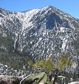
A view of Tahquitz from Suicide Rock, showing both Lily Rock and the peak
|
|
| Highest point | |
| Elevation | 8,846 ft (2,696 m) NGVD 29 |
| Prominence | 766 ft (233 m) |
| Listing | Hundred Peaks Section |
| Geography | |
| Parent range | San Jacinto Mountains |
| Topo map | San Jacinto Peak |
Tahquitz Peak is a tall rock formation in Southern California. It stands about 8,846 feet (2,696 meters) high. This granite peak is part of the San Jacinto Mountains. It is located above the mountain town of Idyllwild.
Tahquitz is a popular spot for both hiking and rock climbing. It has a steep path to the top. The peak is known for its fire lookout station. It is also famous for its rock climbing areas. A special system for rating climbing routes, called the Yosemite Decimal System, was made better here.
Contents
Exploring Tahquitz Peak
You can reach Tahquitz Peak using several trails. One path, the South Ridge trail, starts in Idyllwild. This trail is about four miles long. It climbs about 2,400 feet (730 meters) to the peak.
Another way to reach the peak is via the Devil's Slide Trail. This trail is about 4.8 miles long. It also starts in Idyllwild. You can also get to the peak from the Palm Springs Aerial Tramway. This is a longer hike, about ten miles.
Tahquitz Peak is used as a fire lookout. From late spring to mid-fall, rangers watch for fires from a station on the peak. They have amazing 270-degree views of the area.
The Story Behind the Name
The name Tahquitz comes from a legend. It is named after a spirit from the Soboba Indian tribe. This name first appeared on a map in 1901.
Two other famous climbing spots are nearby. These are Tahquitz Rock and Suicide Rock.
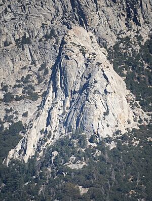
Tahquitz Rock is also called Lily Rock. It is about 0.45 miles (0.72 kilometers) from Tahquitz Peak. Some say it looks white like a lily. Another idea is that it was named after Lily Eastman. She was the daughter of an important person in the early history of Riverside.
Suicide Rock is about 1.6 miles (2.6 kilometers) away. More than 300 climbing paths have been found there.
In 2018, a large fire called the Cranston Fire burned near Tahquitz Peak. It came close to the fire lookout station.
Climbing Adventures
In the 1930s, people started looking for new rock climbing places in Southern California. Tahquitz was "discovered" for climbing in 1935. The first major climb, "The Trough," happened in 1936. Soon after, other classic routes like "Angel's Fright" were climbed.
By 1940, many climbing routes were set up. After World War II, climbing became even more popular. A famous climber named Royal Robbins helped create many new and harder climbs in the 1950s. Climbers started trying more difficult paths. One very hard climb, "The Vampire," was first done in 1959. It was later climbed without special tools in 1973. It is now one of the best free climbs in Southern California.
New climbing shoes helped climbers in the 1960s. They could now try even harder routes. Nearby Suicide Rock also became a popular climbing spot.
The Yosemite Decimal System
The Yosemite Decimal System (YDS) was created at Tahquitz Peak. This system helps climbers rate how hard a climb is. In the 1950s, climbers like Royal Robbins needed a better way to describe climbs. The old ways of saying "easy," "moderate," or "hard" were not enough.
So, Robbins and other climbers developed the YDS. It uses numbers like 5.0 to 5.9 for climbs. This system quickly became the standard for climbing in the United States. It helped climbers understand how challenging a route would be.
Even though many climbs have been done, new ones are still being found. The Idyllwild Area Historical Society museum has lots of information about the early climbing history of Tahquitz and Suicide Rock.
Nature at Tahquitz
A special plant called Ivesia callida lives only in the San Jacinto Range. It is also known as Tahquitz mousetail.
See also
- Tahquitz (spirit), the Cahuilla spirit the Peak was named for.
 | Aaron Henry |
 | T. R. M. Howard |
 | Jesse Jackson |


