Tango Province facts for kids
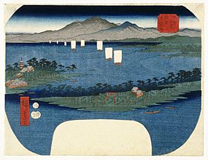
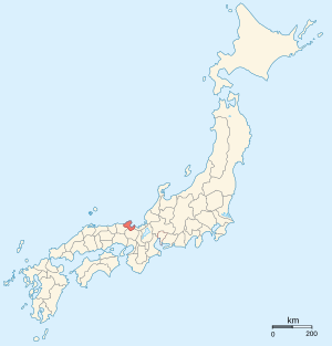
Tango Province (丹後国 (Tango no Kuni)) was an old area in Japan. It was located in what is now Kyoto Prefecture on the island of Honshū. Sometimes, people called it Tanshū (error: {{nihongo}}: Japanese or romaji text required (help)), along with Tamba Province.
Tango Province shared its borders with Tajima, Tamba, and Wakasa provinces. The main city, or capital, of Tango Province was either Maizuru or Miyazu.
Contents
A Look at Tango Province's Past

How Tango Province Began
Tango Province was created a very long time ago. In the year 713, it was officially separated from Tamba Province. This meant it became its own distinct area.
Changing to Prefectures
Much later, during the Meiji period (1868-1912), big changes happened in Japan. The old provinces, like Tango, were turned into new areas called prefectures. This change happened in the 1870s, and it updated how Japan was organized on maps.
Where Tango Province Was
Tango Province was located on the coast. It faced the Sea of Japan. This gave it access to the sea.
Important Shrines and Temples
Kono jinja was a very important place in Tango. It was the main Shinto shrine (called an ichinomiya) for the province. Shinto shrines are places of worship in Japan.
Related Pages
See also
 In Spanish: Provincia de Tango para niños
 | James Van Der Zee |
 | Alma Thomas |
 | Ellis Wilson |
 | Margaret Taylor-Burroughs |


